Rhynern
Arnsberg region geography stubsFormer municipalities in North Rhine-WestphaliaHammVillages in North Rhine-Westphalia

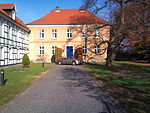
Rhynern, also Hamm-Rhynern, is the largest city district by area (59.22 km ²) of the city of Hamm, Westphalia, Germany. Until 1968 Rhynern was the administrative center of Amt Rhynern.
Excerpt from the Wikipedia article Rhynern (License: CC BY-SA 3.0, Authors, Images).Rhynern
Sankt-Reginen-Platz, Hamm Rhynern
Geographical coordinates (GPS) Address Nearby Places Show on map
Geographical coordinates (GPS)
| Latitude | Longitude |
|---|---|
| N 51.629944444444 ° | E 7.8581111111111 ° |
Address
St. Regina
Sankt-Reginen-Platz
59069 Hamm, Rhynern
North Rhine-Westphalia, Germany
Open on Google Maps


