place

Diamond Point, Washington

Buildings and structures in Clallam County, WashingtonClallam County, Washington geography stubsPopulated coastal places in Washington (state)Unincorporated communities in Clallam County, WashingtonUnincorporated communities in Washington (state)
Use mdy dates from July 2023
US Quarantine Station, 1905 (MOHAI 6076)

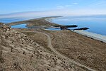
Diamond Point is an unincorporated community in Clallam County, Washington, United States, located on the Miller Peninsula. Diamond Point is at the northwestern corner of Discovery Bay, and looks north to Protection Island. While some homes are located along the water on the point itself, most homes are located on the bluffs and plateau above Discovery Bay and the Strait of Juan de Fuca. Diamond Point is mostly residential and is serviced by Diamond Point Airport. Some pilots access the airport by taxiing their aircraft on and across county roads adjacent to the airport. Miller Peninsula State Park is located on all landward sides of the community. This park has miles of hiking trails and is accessible from the community or from a number of nearby trailheads.

Excerpt from the Wikipedia article Diamond Point, Washington (License: CC BY-SA 3.0, Authors, Images).

Diamond Point, Washington
Beach Drive,

Geographical coordinates (GPS) Address Nearby Places
placeShow on map

Wikipedia: Diamond Point, WashingtonContinue reading on Wikipedia

Geographical coordinates (GPS)

Latitude Longitude
N 48.094166666667 ° E -122.91305555556 °
placeShow on map

Address

Beach Drive

Beach Drive

Washington, United States
mapOpen on Google Maps

US Quarantine Station, 1905 (MOHAI 6076)
Share experience

Nearby Places

Protection Island (Washington)

Protection Island is an island located in the Strait of Juan de Fuca just north of Discovery Bay in northeastern Jefferson County, Washington, United States. The island has a land area of 379 acres (153 ha). It is a federally protected National Wildlife Refuge; boats are not permitted within 200 yards (180 m) for the safety and health of wildlife on and near the shores. There is only one individual still living on the island not associated with the government. Marty Bluewater has lifetime use of his inholding cabin on the island's southern bluffs. The island also houses a caretaker, a volunteer hired by the United States Fish and Wildlife Service, to watch over the island and take care of its many inhabitants. Boat trips from nearby Port Townsend, Washington provide ecotourism visits for viewing wildlife from the adjacent waters. Spanish explorers were the first Europeans to find the island. In 1790 it was given the name Isla de Carrasco, in honor of Juan Carrasco. It was given its present name by George Vancouver in 1792.Protection Island National Wildlife Refuge was designated in 1982 to protect the entire island and its coast. Approximately 70 percent of the nesting seabird population of Puget Sound and the Strait of Juan de Fuca nest on the island, which includes one of the largest nesting colonies of rhinoceros auklets in the world and the largest nesting colony of glaucous-winged gulls in Washington. The island contains one of the last two nesting colonies of tufted puffins in the Puget Sound area. It is on the flyway for many migrating birds. Seals (harbor and elephant), sea lions, orcas, and other cetaceans are often seen nearby. About 1,000 harbor seals depend upon the island for a pupping and rest area.The refuge is closed to visitation to protect the fragile habitat. Visitors may view the island by boat; a 200-yard off-shore buffer is enforced to ensure adult birds are not flushed from their nests. The waters surrounding the North Olympic Peninsula support five additional refuges: Flattery Rocks, Quillayute Needles, Copalis, Dungeness, and San Juan Islands. Protection Island is managed as part of the Washington Maritime National Wildlife Refuge Complex.

Quimper Peninsula

The Quimper Peninsula is a narrow peninsula forming the most northeastern extent of the Olympic Peninsula of Washington state in the northwestern United States of America. The peninsula is named after the Peruvian-born Spanish explorer Manuel Quimper who, in command of Princess Royal, charted the north and south coasts of the Strait of Juan de Fuca during the summer of 1790. The Spanish had given the name Quimper to today's New Dungeness Bay, which George Vancouver had renamed New Dungeness. In 1838 Charles Wilkes gave the peninsula the name Dickerson, but the U.S. Coast Survey renamed it with Quimper's name.The Quimper Peninsula is defined by Discovery Bay to the west, the Strait of Juan de Fuca to the north, and Port Townsend Bay to the east. From the isthmus it extends approximately seven miles to the north-northwest and then curves to the northeast for another four miles before terminating at Point Wilson. For most of its length the width is less than four miles. This peninsula forms the westernmost boundary of Admiralty Inlet. Its approximate geographic center is at coordinates 48°5′N 122°50′W. Although the Quimper Peninsula is geographically the most isolated part of Jefferson County, Washington, it is the most economically developed and densely populated part of the county. Port Townsend, the county seat and only incorporated city in the county, is located at the end of the peninsula. The communities of Cape George, Port Hadlock, Irondale, and Chimacum are on the peninsula south of Port Townsend. The name "Quimper Peninsula" has become a convenient means of referring collectively to Port Townsend and the surrounding communities. When non-native explorers first arrived in the late 18th century, and the first non-native settlers in the mid-19th century, there were no permanent Native American settlements on the northern part of the peninsula as fresh water was obtainable only from streams at the southern end of the peninsula. The Chimakum lived along the southeastern shore of the peninsula and members of the S'Klallam along the southwestern shore. Because of strong tidal currents in Admiralty Inlet, Native Americans traveling between the Strait of Juan de Fuca and Puget Sound would often portage their canoes across the Quimper Peninsula by way of a prairie they called Kah Tai, that traversed the peninsula in present-day Port Townsend.

Discovery Bay, Washington

Discovery Bay is an unincorporated community in Jefferson County, Washington. The community of Discovery Bay is an area near the intersection of U.S. Route 101 and State Route 20, at the foot of Discovery Bay – roughly midway between the larger communities of Port Townsend to the northeast and Sequim to the northwest. It is a mix of residential areas and commercial enterprises, including crabbing, oystering, clamming, timbering, security training and gravel extraction. A few restaurants and stores on US 101 near SR 20 primarily serve drivers and truckers along US 101. Discovery Bay is the current name generally associated with the area. Its use for the community, as opposed to the bay itself, is relatively recent. The original communities in the area, primarily mill towns that waxed and waned along with the local timber industry, had different names: Fairmont is a group of residences at the southeast corner of the bay, off SR 20 just northeast of US 101. Discovery Junction is an abandoned railroad junction near Fairmont. Uncas is an old mill community to the southwest of Fairmont, on the south side of US 101. Fort Discovery is the original location of Capt. Vancouver's camp and the present headquarters of Security Services NW. Maynard is an old mill community to the north of Uncas, along US 101 at the southwest corner of the bay. An abandoned sawmill just to the east of US 101 is a well-known remnant of this community. The mill has often been incorrectly identified as the 1858 Port Discovery Mill (see Port Discovery, below). It was, in fact, the Maynard Mill.These names often appear on maps and persist in local road names. The mill communities no longer have the population or visibility they enjoyed when the mills were operating, making these hamlets primarily matters of local historical interest. However, changing demographics and rising property values are leading to redevelopment of this area, and breathing new life into older names. South Discovery now constitutes the entirety of the area around Discovery Bay, especially the area between Port Discovery and Port Townsend. The South Discovery voting precinct includes areas away from Discovery Bay, as well. Several nearby place names are also prominent in Discovery Bay history: Eaglemount is an area on the hills to the south of Discovery Bay, on the east of US 101 above high bluffs over Discovery Bay. (Eaglemount is sometimes depicted as a location on SR 20, but in fact it is reached by turning south on Eaglemount Road from SR20.) Port Discovery is the location of George Vancouver's 1792 visit to Discovery Bay. Many sources incorrectly identify the current Discovery Bay community as the location of Port Discovery; however, Port Discovery was several miles to the north, at Mill Point on the west side of the bay. The site is along US 101, near today's Broders Road.There are several other communities located on or near the shores of Discovery Bay. Port Townsend occupies the northern end of the Quimper Peninsula, 5 miles (8 km) east of the northeast corner of the bay. The downtown area of Port Townsend, a famous seaport (once the major port of the region, before the rise of Seattle), is on the opposite side of the peninsula. Cape George is located on high bluffs at the northeast entrance of the bay; Beckett Point is a shoreline community a mile south. Another shoreline community, Adelma Beach is halfway down the bay. Gardiner is an unincorporated community several miles to the west along US 101, established by Herbert Gardner in the late 19th century. Diamond Point is located at the northwest mouth of the bay, opposite Protection Island, which once hosted a government quarantine station.