Atherstone Rural District
AtherstoneDistricts of England abolished by the Local Government Act 1972Districts of England created by the Local Government Act 1894History of WarwickshireRural districts of England ... and 1 more
Use British English from August 2012
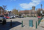
Atherstone Rural District was located in the administrative county of Warwickshire, England, from 1894 to 1974. It was named after its main town and administrative headquarters of Atherstone. Over the years the district gained territory on the abolition of neighbouring rural districts. In 1932, it gained part of Nuneaton Rural District and in 1965 it gained most of Tamworth Rural District. As with all rural districts, Atherstone RD was abolished in 1974 (by the Local Government Act 1972) and was merged with part of the Meriden Rural District to form the new non-metropolitan district of North Warwickshire.
Excerpt from the Wikipedia article Atherstone Rural District (License: CC BY-SA 3.0, Authors).Atherstone Rural District
Monks Park Lane, North Warwickshire
Geographical coordinates (GPS) Address Nearby Places Show on map
Geographical coordinates (GPS)
| Latitude | Longitude |
|---|---|
| N 52.57 ° | E -1.55 ° |
Address
Atherstone Golf Club
Monks Park Lane
CV9 2RJ North Warwickshire
England, United Kingdom
Open on Google Maps


