place

St Mary The Church of Our Lady, Merevale

Church of England church buildings in Warwickshire
Merevale Our Lady Church geograph.org.uk 480715

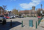
St. Mary The Church of Our Lady Merevale, is a historic parish church in Merevale, Warwickshire is known for its Jesse window. Originally, it was part of Merevale Abbey, but now is a Church of England parish church.

Excerpt from the Wikipedia article St Mary The Church of Our Lady, Merevale (License: CC BY-SA 3.0, Authors, Images).

St Mary The Church of Our Lady, Merevale
Merevale Lane, North Warwickshire Merevale CP

Geographical coordinates (GPS) Address External links Nearby Places
placeShow on map

Wikipedia: St Mary The Church of Our Lady, MerevaleContinue reading on Wikipedia

Geographical coordinates (GPS)

Latitude Longitude
N 52.57656 ° E -1.57282 °
placeShow on map

Address

Church of Our Lady

Merevale Lane
CV9 2LB North Warwickshire, Merevale CP
England, United Kingdom
mapOpen on Google Maps

linkWikiData (Q7590519)
linkOpenStreetMap (197748967)

Merevale Our Lady Church geograph.org.uk 480715
Share experience

Nearby Places

Atherstone rail accident

The Atherstone rail accident happened near Atherstone railway station in the small hours of the morning of 16 November 1860, and killed 10 people. A special cattle train from Holyhead to London via Peterborough was shunting just south of Atherstone station to let the Scotch mail train pass. Before the cattle train could clear the main line, the mail train struck it. The four rear carriages of the cattle train were 'shivered to pieces' killing all nine Irish drovers who were asleep in the brake van and the fireman of the mail train, James Sherry. 29 cattle were killed or had to be slaughtered soon afterwards. The Duke and Duchess of Montrose were passengers on the mail train but escaped without injury. The driver of the mail train was not aware that a cattle train was ahead of him when they left Tamworth (the preceding station) and claimed he had not seen the advance signal at all approaching Atherstone station, but did not worry as he was not aware of there being a train ahead of him. By the time he saw a red signal just before the station he immediately applied the brakes but it was too late to avoid the collision. The enquiry criticized the decision to allow the cattle train to leave Tamworth ahead of the mail train without allowing sufficient time to clear the lines at Atherstone, and of the failure to warn the mail train driver about the train ahead of him. It also criticized the driver for not seeing the advance red signal. A further recommendation was that in future in cattle trains drovers' vans be placed in front of the cattle trucks instead of behind them.

North Warwickshire
North Warwickshire

North Warwickshire is a local government district with borough status in the ceremonial county of Warwickshire, West Midlands, England. The borough includes the two towns of Atherstone (where the council is based) and Coleshill, and the large villages of Polesworth, Kingsbury, Hartshill and Water Orton. The North Warwickshire district was created on 1 April 1974 by a merger of the Atherstone Rural District and parts of the Meriden Rural District (the rest of which was merged into the West Midlands county).North Warwickshire is a mostly rural area with several small market towns and a number of former mining villages. The area historically had a large coal mining industry, but this has now all died out. The last coal mine in the area, Daw Mill at Arley, closed in 2013. The district is relatively remote from the rest of Warwickshire, as the county is almost split in two by the West Midlands Boroughs of Solihull and Coventry. The borough borders the neighboring Warwickshire district of Nuneaton and Bedworth to the south-south-east, Staffordshire to the west and northwest, Leicestershire to the north and northeast, the cities of Birmingham and Coventry to the southwest and southeast. The borough's landscape is primarily of the mildly undulating agricultural variety, with the North Warwickshire plateau rising to 177 m (581 ft) above sea-level at Bentley Common, 2.5 miles southwest of Atherstone. The most significant bodies of water within North Warwickshire are Kingsbury Water Park, Shustoke Reservoir, the River Blythe and the mid-section of the Coventry Canal. The boundaries of North Warwickshire are similar to those of the North Warwickshire parliamentary constituency. However the constituency also includes the town of Bedworth, but does not include the villages of Hartshill and Arley. The local MP is Craig Tracey. In 2007 the Conservatives took overall control of the borough council for the first time since the creation of the council within its current boundaries. The council was retaken by Labour in 2011, then returned to Conservative control in 2015.