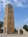
Ramla

Ramla or Ramle (Hebrew: רַמְלָה, Ramle; Arabic: الرملة, ar-Ramleh) is a city in the Central District of Israel. The city was founded in the early 8th century CE by the Umayyad prince Sulayman ibn Abd al-Malik as the capital of Jund Filastin, the district he governed in Bilad al-Sham before becoming caliph in 715. The city's strategic and economic value derived from its location at the intersection of the Via Maris, connecting Cairo with Damascus, and the road connecting the Mediterranean port of Jaffa with Jerusalem. It rapidly overshadowed the adjacent city of Lydda, whose inhabitants were relocated to the new city. Not long after its establishment, Ramla developed as the commercial centre of Palestine, serving as a hub for pottery, dyeing, weaving, and olive oil, and as the home of numerous Muslim scholars. Its prosperity was lauded by geographers in the 10th–11th centuries, when the city was ruled by the Fatimids and Seljuks. It lost its role as a provincial capital shortly before the arrival of the First Crusaders (c. 1099), after which it became the scene of various battles between the Crusaders and Fatimids in the first years of the 12th century. Later that century, it became the centre of a lordship in the Kingdom of Jerusalem, a Crusader state established by Godfrey of Bouillon. Ramla had an Arab-majority population before most were expelled or fled during the 1948 Arab–Israeli War. The town was subsequently repopulated by Jewish immigrants. As of 2019, Ramla is one of Israel's mixed cities, with a population 76% Jewish and 24% Arab (see Arab citizens of Israel). In recent decades, attempts have been made to develop and beautify the city, which has been plagued by neglect, financial problems and a negative public image. New shopping malls and public parks have been built, and a municipal museum was opened in 2001.
Excerpt from the Wikipedia article Ramla (License: CC BY-SA 3.0, Authors, Images).Ramla
Yehuda Stein,
Geographical coordinates (GPS) Address Nearby Places Show on map
Geographical coordinates (GPS)
| Latitude | Longitude |
|---|---|
| N 31.9275 ° | E 34.8625 ° |
Address
יהודה שטיין/שד. דוד רזיאל
Yehuda Stein
7031011 , Qaryat Jawarish
Center District, Israel
Open on Google Maps


