place

Channel Islands Harbor

Channel Islands of CaliforniaPorts and harbors of CaliforniaTransportation buildings and structures in Ventura County, CaliforniaUse mdy dates from January 2023
Hampton Inn Oxnard Aerial

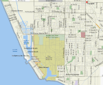
Channel Islands Harbor is a small craft harbor and shore-protection project in Oxnard, California at the southern end of the Santa Barbara Channel. It is the fifth largest harbor for small-craft recreation in the state of California and is a waterfront resort, recreation, and dining marketplace. Recreational activities include diving, boat charters, sea kayaking, sportfishing, and whale watching (gray whales January through early April; blue and humpback whales July to September). The horseshoe shaped harbor contains 166 acres (0.67 km2) of water surrounded by 126 acres (0.51 km2) of land and supports more than 2,500 vessels, four yacht clubs, and nine full-service marinas. The five Channel Islands are a popular destination, the closest of which is Anacapa Island. The Ventura County Maritime Museum has a regularly rotating exhibit, maritime-themed art, and model ships. Water taxis are available to drop diners and shoppers at various docks within the harbor. Every three years the harbor is host to the Channel Islands Tall Ships Festival which includes between two and five large sailing vessels and draws thousands of visitors.

Excerpt from the Wikipedia article Channel Islands Harbor (License: CC BY-SA 3.0, Authors, Images).

Channel Islands Harbor
Peninsula Road, Oxnard

Geographical coordinates (GPS) Address Nearby Places
placeShow on map

Wikipedia: Channel Islands HarborContinue reading on Wikipedia

Geographical coordinates (GPS)

Latitude Longitude
N 34.17 ° E -119.225 °
placeShow on map

Address

Peninsula Road

Peninsula Road
93035 Oxnard
California, United States
mapOpen on Google Maps

Hampton Inn Oxnard Aerial
Share experience

Nearby Places

Port of Hueneme
Port of Hueneme

The Port of Hueneme in the city of Port Hueneme, California, United States, is the only deep water harbor between Los Angeles and the San Francisco Bay area. Located in Ventura County on the Santa Barbara Channel, the port complex not only serves international shipping businesses but is an operating facility of Naval Base Ventura County (NBVC).The original wharf was built to serve the new farmers on the Oxnard Plain and became the largest grain shipping port south of San Francisco. The modern port continues this legacy as a dominant port for agribusiness (fruit and other produce), liquids, fresh seafood and vehicles. Bulk cargo and automobiles are specialties of the port and distinguishes it from much larger ports. General cargo includes household goods and oversized cargo. This includes providing support services for the offshore oil industry in the Santa Barbara Channel.The port has a direct highway connection to the nationwide freight network which raises the status of the port and gives it access to more federal funding resulting in a competitive advantage. The port owns a railroad line through Port Hueneme and south Oxnard that is operated by the Ventura County Railroad and connects nationally to the Coast Route of Union Pacific. The District does not perform cargo handling operations as the companies shipping through the port take responsibility in cooperation with the port district. The commercial port operations have five deep-water berths.The Navy controls the ship movements. As a shared port between NBVC and the Oxnard Harbor District, the U.S. Navy has over 4,500 feet (1,400 m) of berthing space for various ship platforms for use by tenant commands of NBVC: Port Hueneme and transient government contract/military shipping.