St Cuthbert Out

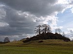
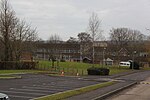
St Cuthbert Out, sometimes Wells St Cuthbert Out, is a civil parish in the Mendip district of Somerset, England. It entirely surrounds (but does not include) the city and parish of Wells. According to the 2011 census it had a population of 3,749.The parish is named for the Church of St Cuthbert, Wells and was created in 1866. The historic ecclesiastical parish of Wells St Cuthbert had been split into two, with the Wells St Cuthbert In parish covering the area inside the city of Wells (except for the small area covered by the cathedral's liberty of Wells St Andrew). Population centres in the parish are Dinder, Wookey Hole and East, West and South Horrington. It also includes the smaller settlements of Burcott, Coxley, Dulcote, Easton, Launcherley, Lower Milton, Polsham, Southway, Upper Milton and Worminster. Wookey itself is a separate parish. The parish is crossed by the national Monarch's Way long distance footpath, as well as the more local Mendip Way footpath, and National Cycle Route 3.
Excerpt from the Wikipedia article St Cuthbert Out (License: CC BY-SA 3.0, Authors, Images).St Cuthbert Out
Geographical coordinates (GPS) Address Nearby Places Show on map
Geographical coordinates (GPS)
| Latitude | Longitude |
|---|---|
| N 51.1796 ° | E -2.6952 ° |
Address
BA5 1RP , St Cuthbert Out
England, United Kingdom
Open on Google Maps


