Loch Fergus
Crannogs in ScotlandFreshwater lochs of ScotlandHistory of South AyrshireLakes of South AyrshireLochs of South Ayrshire

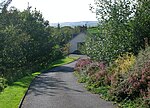
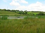
Loch Fergus (NS 3932 1823) is a freshwater post-glacial "Kettle Hole" sometimes recorded as Fergus Loch. It is quite visible and is situated in a low-lying area close to the B742 road between the farms and dwellings of Trees, Lochfergus and Bowmanston in the Parish of Ayr, South Ayrshire, Scotland. The loch lies to the north of Martnaham Loch, four miles (six kilometres) east-southeast of Ayr. It drains to the southwest into the Snipe Loch.
Excerpt from the Wikipedia article Loch Fergus (License: CC BY-SA 3.0, Authors, Images).Loch Fergus
B742,
Geographical coordinates (GPS) Address Nearby Places Show on map
Geographical coordinates (GPS)
| Latitude | Longitude |
|---|---|
| N 55.431583333333 ° | E -4.5408611111111 ° |
Address
B742
KA6 6ES
Scotland, United Kingdom
Open on Google Maps


