Geography of the United Kingdom

The United Kingdom is a sovereign state located off the north-western coast of continental Europe. With a total area of approximately 248,532 square kilometres (95,960 sq mi), the UK occupies the major part of the British Isles archipelago and includes the island of Great Britain, the north-eastern one-sixth of the island of Ireland and many smaller surrounding islands. It is the world's 7th largest island country. The mainland areas lie between latitudes 49°N and 59°N (the Shetland Islands reach to nearly 61°N), and longitudes 8°W to 2°E. The Royal Observatory, Greenwich, in south-east London, is the defining point of the Prime Meridian. The UK lies between the North Atlantic and the North Sea, and comes within 35 km (22 mi) of the north-west coast of France, from which it is separated by the English Channel. It shares a 499 km (310 mi) international land boundary with the Republic of Ireland. The Channel Tunnel bored beneath the English Channel now links the UK with France. The British Overseas Territories and Crown Dependencies are covered in their own respective articles, see below.
Excerpt from the Wikipedia article Geography of the United Kingdom (License: CC BY-SA 3.0, Authors, Images).Geography of the United Kingdom
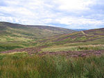
Ribble Valley Bowland Forest High
Geographical coordinates (GPS) Address Nearby Places Show on map
Geographical coordinates (GPS)
| Latitude | Longitude |
|---|---|
| N 54 ° | E -2.5 ° |
Address
Bowland Forest High
Ribble Valley, Bowland Forest High
England, United Kingdom
Open on Google Maps


