place

Thornton le Fen

Civil parishes in LincolnshireEast Lindsey DistrictUse British English from October 2014Villages in Lincolnshire
Gipsey Bridge geograph.org.uk 463259

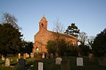
Thornton Le Fen is a small civil parish in the East Lindsey district of Lincolnshire, England. It is situated approximately 4 miles (6 km) north from the town of Boston. Thornton Le Fen lies in Wildmore Fen, created in 1812 after the fen was drained in 1802. It is mostly farmland with a population of 345, and contains the hamlets of Bunkers Hill and Gipsey Bridge. The Census of 2011 showed a reduced population of 322.Gipsey Bridge School was built in 1859 and was taken over by the Wildmore Fen United District School Board in 1879, when it was renamed the Gipsey Bridge Board School, until the Board was abolished in 1903. Following this it was known as Thornton Le Fen Council School, Thornton Le Fen County School, and Gipsey Bridge County Primary School, before it took its present name, Gipsey Bridge Primary School, in 1999.

Excerpt from the Wikipedia article Thornton le Fen (License: CC BY-SA 3.0, Authors, Images).

Thornton le Fen
Leagate Road,

Geographical coordinates (GPS) Address Nearby Places
placeShow on map

Wikipedia: Thornton le FenContinue reading on Wikipedia

Geographical coordinates (GPS)

Latitude Longitude
N 53.031615 ° E -0.092694 °
placeShow on map

Address

Gipsey Bridge Preschool

Leagate Road
PE22 7BU , Thornton le Fen
England, United Kingdom
mapOpen on Google Maps

Gipsey Bridge geograph.org.uk 463259
Share experience

Nearby Places

North Forty Foot Bank

The North Forty Foot Bank is a settlement which runs about 6 miles (10 km) along the North Forty Foot Drain, about five to nine miles north-west of Boston Lincolnshire, England. It begins just south of the parish of Chapel Hill and runs along the drain to Toft Tunnel, just north of Hubberts Bridge. Despite its length, it only consists of the area on the north side of the drain, which was built in 1720 by Earl Fitzwilliam. The North Forty Foot Bank forms the boundary between Harts Grounds and Pelhams Lands. A row of 29 brick and slate cottages were built between the North Forty Foot Bank and the hamlet of Brothertoft by Major John Cartwright to accommodate the workers of his red brick woad mill in the late 18th century. This place was then called Isatica, which is Latin for "woad". After Cartwright left Brothertoft for London, the hamlet of Isatica fell into ruin and disappeared.Formerly extra-parochial, the North Forty Foot Bank was created a civil parish in 1858, but in 1906 became part of the civil parish of Holland Fen with Brothertoft. Settlements within North Forty Foot Bank include: Pelhams Land Harts Ground Holland Fen Hedgehog Bridge lies about 5 miles (8.0 km) north west of Boston, Lincolnshire, on the North Forty Foot Bank. It was named after a hump-backed bridge over the drain which no longer exists. Hedgehog Bridge School was built in 1880 by the North-East Holland Fen School Board for 95 children. It opened on 4 April 1881, became a Council School in 1903, and a County School about 1947. It finally closed in December 1969, and was demolished in 2010. Toft Tunnel lies at the junction of the North Forty Foot Bank and the B1192 Langrick Road. Today it consists mainly of farms.

Carrington, Lincolnshire

Carrington is a village in the civil parish of Carrington and New Bolingbroke, in the East Lindsey district of Lincolnshire, England. It is situated approximately 7 miles (11 km) north from the market town of Boston. It lies within The Fens and was largely uninhabited marshland until the early nineteenth century. Drainage of an area known as West Fen began in 1802, and in 1812 a township called Carrington was created covering some of the drained land, named after Robert Smith, 1st Baron Carrington, the main landowner. The township became a civil parish in 1858. The civil parish of Carrington also included New Bolingbroke, 1.5 miles (2.4 km) to the north. The parish was renamed "Carrington and New Bolingbroke" in November 2022, at which point the parish council also declared the parish to be a town, allowing it to take the style "town council" and appoint a mayor. The parish also contains the hamlet of Medlam. The parish has a population of 564 according to the 2001 census, reducing slightly to 554 at the 2011 Census.Carrington church is dedicated to St Paul, and was built of red brick in 1816 under the Fen Chapel Act (1816), with its chancel being added in 1872. It is a Grade II listed building. Carrington and New Bolingbroke were separate ecclesiastical parishes until 1961 when they were united.Carrington's school, the Medlam School, was opened in February 1881 by the West Fen United District School Board which existed from 1879 to 1903. By the time of its closure in 1987 it was known as Carrington County Primary School. Children now attend school in nearby Stickney.Carrington Rally is an annual event which has taken place each spring for over 50 years, and is a steam and tractor show which supports local charities.The Carrington Glasshouse of Dyson Farming is based in Carrington. It is six hectares in size and 424 meters in length, with 700,000 strawberry plants.