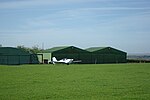
Geerlane
Hamlets in DerbyshireNorth East Derbyshire District
Geerlane is a hamlet in North East Derbyshire, England.The hamlet is located in Moss Valley, by the side of The Moss. It has a farm, called Geerlane Farm, where a farmer was killed in 2010 after being trampled on by his cattle.The hamlet is located two-thirds mile (1.1 km) north of Troway, one-half mile (0.80 km) west of Ford, and 1+2⁄3 miles (2.7 km) south-east of Charnock in south-eastern Sheffield. There was formerly a small quarry in Geerlane which provided the hamlet's main source of employment. Since its closure, the local economy has been based around farming.
Excerpt from the Wikipedia article Geerlane (License: CC BY-SA 3.0, Authors).Geerlane
Geer Lane, North East Derbyshire
Geographical coordinates (GPS) Address Nearby Places Show on map
Geographical coordinates (GPS)
| Latitude | Longitude |
|---|---|
| N 53.319 ° | E -1.41 ° |
Address
Geer Lane
Geer Lane
S12 3YF North East Derbyshire
England, United Kingdom
Open on Google Maps


