Danish Geodata Agency
The Danish Geodata Agency (GST) (Danish: Geodatastyrelsen), (previously National Survey and Cadastre of Denmark (Danish: Kort & Matrikelstyrelsen, short KMS)), is the Danish state owned central agency responsible for surveying, mapping and land registering of all of Denmark, Greenland, the Faroe Islands and all waters associated with these. Geodatastyrelsen is an agency under the Danish Ministry of the Environment.The overall goal of Geodatastyrelsen is to supply and ensure that everyone in the Danish society has access to reliable and accurate maps and information on all parts of the Realm. Until 31 December 2004, KMS was a Sector research institute for the Ministry of the Environment in the fields of seismology, geodynamic and geodesy. The seismology part was detached on 1 July 2004 and moved under the responsibility of Geological Survey of Denmark and Greenland (GEUS). On 1 January 2005, the geodesy part was detached and together with Danish Space Research Institute it formed Danish National Space Center.
Excerpt from the Wikipedia article Danish Geodata Agency (License: CC BY-SA 3.0, Authors).Danish Geodata Agency
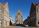
Bygmestervej, Copenhagen Municipality
Geographical coordinates (GPS) Address Nearby Places Show on map
Geographical coordinates (GPS)
| Latitude | Longitude |
|---|---|
| N 55.705 ° | E 12.5356 ° |
Address
Natur- og Miljøklagenævnet
Bygmestervej
2400 Copenhagen Municipality, Utterslev
Capital Region of Denmark, Denmark
Open on Google Maps


