place

Fin Cop

Archaeological sites in DerbyshireHill forts in DerbyshireLime kilns in the United KingdomMountains and hills of DerbyshireScheduled monuments in Derbyshire
Fin Cop Jonathan Clitheroe

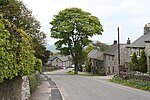
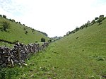
Fin Cop is a hill and an associated Iron Age hill fort in Monsal Dale, close to Ashford in the Water in Derbyshire, England.The fort shows evidence of hurried construction, indicating a defensive response to a real threat, rather than the more usual assumption that such forts were a display of status and prestige. The hillfort, along with an adjacent bowl barrow, lime kiln and quarry, constitutes a Scheduled Ancient Monument. In 2011 excavations unearthed a mass burial containing only women and children, the first such segregated burial in Iron Age Britain. Some animal bones were also found, suggesting the inhabitants kept livestock. The remains were relatively well preserved due to the limestone geology of the hill. Carbon dating of the site suggests it was constructed between 440BC and 390BC.

Excerpt from the Wikipedia article Fin Cop (License: CC BY-SA 3.0, Authors, Images).

Fin Cop
Brushfield Lane, Derbyshire Dales

Geographical coordinates (GPS) Address Nearby Places
placeShow on map

Wikipedia: Fin CopContinue reading on Wikipedia

Geographical coordinates (GPS)

Latitude Longitude
N 53.235833333333 ° E -1.7369444444444 °
placeShow on map

Address

Brushfield Lane
SK17 8SZ Derbyshire Dales
England, United Kingdom
mapOpen on Google Maps

Fin Cop Jonathan Clitheroe
Share experience

Nearby Places

Cressbrook
Cressbrook

Cressbrook is a village in the Peak District National Park in Derbyshire. It lies in Water-cum-Jolly Dale at the foot of Cressbrook Dale. Population details at the 2011 Census are included in the civil parish of Litton. Before its Enclosure Act of 1762 Cressbrook did not exist. It later grew up around a textile mill complex built alongside the River Wye, first by Richard Arkwright and then later by his son Richard, JL Philips and Brother Cotton Spinners and McConnel and Company. Until McConnel's period of ownership the village did not exist beyond a collection of buildings in the immediate vicinity of the mill. When McConnel's workforce objected to the quality of the housing available he took it upon himself to build the model village that became Cressbrook. Building started in the late 1830s and was later extended by Henry McConnel's daughter, Mary Worthington, in 1902 to include a village club, modelled on a working men's club. Cressbrook Mill went bankrupt in 1965, after which time it changed from being a private mill estate to the public village that it now is. The Monsal Trail passes Cressbrook Mill. This 8.5-mile (13.7-kilometre) walk and cycleway mostly follows the old trackbed of the Manchester, Buxton, Matlock and Midlands Junction Railway where, from 1866 to 1959, the village of Cressbrook was served by Monsal Dale railway station. Until May 2011 the Cressbrook Tunnel (and others) were closed to walkers and cyclists for safety reasons and the Trail diverted across the River Wye next to the Mill. David Cannon McConnel emigrated to Queensland, Australia in 1840. In 1841, he established the Cressbrook Homestead named after their home town. The homestead in turn gives its name to the modern-day localities of Cressbrook, Queensland and Lower Cressbrook, Queensland.

Magpie Mine
Magpie Mine

Magpie Mine is a well-preserved disused lead mine near the village of Sheldon in Derbyshire, England, in the parish of Ashford in the Water. The walled enclosure of five lead mines (Magpie Mine, Dirty Red Soil, Great Red Soil, Maypit and Horsesteps) is a protected Scheduled Monument.Mid-Derbyshire has a history of industrial lead mining going back to Roman times. Lead mining at this site goes back to at least the 17th century. The Shuttlebark vein of lead ore was officially opened in 1682. Magpie Mine is recorded back to 1740. After over 200 years of operation, Magpie Mine closed in 1958 and was the last working lead mine in Derbyshire. The Peak District Mines Historical Society now manages the site and has undertaken much restoration work. Between productive, profitable times, there were closures for several years in 1793 and in 1835 because of floods, disputes and drops in the price of lead. In 1833 a bitter dispute led to three miners from the neighbouring Maypitt Mine being suffocated by smoke from fires lit deliberately by miners from the Magpie Mine. A murder trial followed but all of the 24 suspected culprits were freed because they had been provoked and it was also unclear which of them was actually responsible.The renowned mining engineer John Taylor took over management of the mine in 1839 and he established a complex of new limestone buildings and innovative equipment. The square chimney (renovated in 2016) and the circular chimney were both built in 1840. The agent's house, smithy, winding house (now demolished), circular gunpowder house and engine reservoir (to supply boiler and cooling water to the engines) were all constructed in the 1840s. In 1869 the Cornish engine house replaced an earlier engine house building and the winding engine was installed, with the winding drum that still remains. The main shaft was sunk in 1823 and is over 200m deep. The underground channel used to drain floodwater from the mines (the sough) was built from 1873 to 1881 and runs about 2 kilometres (1.2 mi) to its outlet into the River Wye to the north (carrying several million litres of water per day). The mine closed with financial troubles in 1883. It was operating for brief spells between 1913 and 1923 but was then only reopened again in 1950, before finally closing down in 1958. The existing steelwork frame of the headgear above the main shaft and the corrugated iron winding house are from the 1950s. The underground mine shafts are now all closed for safety.A reproduction horse gin has been set up at the Red Soil mine shaft, where the original horse-powered winding gear was used to lift lead ore up to the surface.There is visitor access to the site along footpaths from Sheldon (about 500m north) and from lanes to the west, south and east.