Apelsberg
LichteMountains of ThuringiaThuringia geography stubsThuringian Forest

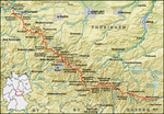
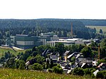
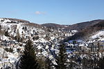
The Apelsberg is a 785.3 m high (above sea level) mountain located in the Thuringian Highland, Thuringia (Germany). It is located close to the municipality of Lichte and the Leibis-Lichte Dam in the Saalfeld-Rudolstadt district in the Thuringian Forest Nature Park. The section of the Rennsteig walkway between Neuhaus am Rennweg, Ernstthal am Rennsteig, and Spechtsbrunn runs close to the mountain.
Excerpt from the Wikipedia article Apelsberg (License: CC BY-SA 3.0, Authors, Images).Apelsberg
Sechs-Kilometer-Weg, Neuhaus am Rennweg
Geographical coordinates (GPS) Address Nearby Places Show on map
Geographical coordinates (GPS)
| Latitude | Longitude |
|---|---|
| N 50.513055555556 ° | E 11.161111111111 ° |
Address
Sechs-Kilometer-Weg
Sechs-Kilometer-Weg
98724 Neuhaus am Rennweg
Thuringia, Germany
Open on Google Maps


