Sauhügel
LichteMountains of ThuringiaThuringia geography stubsThuringian Forest
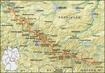
The Sauhügel is a 721.7 m high (above sea level) mountain located in the Thuringian Highland, Thuringia (Germany). It is located close to the municipality of Lichte and the Leibis-Lichte Dam in the Saalfeld-Rudolstadt district in the Thuringian Forest Nature Park within walking distance of the Rennsteig.
Excerpt from the Wikipedia article Sauhügel (License: CC BY-SA 3.0, Authors).Sauhügel
Dorststraße, Neuhaus am Rennweg
Geographical coordinates (GPS) Address Nearby Places Show on map
Geographical coordinates (GPS)
| Latitude | Longitude |
|---|---|
| N 50.532222222222 ° | E 11.18 ° |
Address
Dorststraße
98724 Neuhaus am Rennweg
Thuringia, Germany
Open on Google Maps


