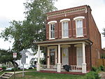
Fort Craig (Virginia)

Fort Craig was a small lunette that the Union Army constructed in September 1861 in Arlington County (at that time Alexandria County) in Virginia during the American Civil War. The lunette was part of the Civil War defenses of Washington (see Washington, D.C., in the American Civil War). The lunette stood less than a mile away from Arlington House, the Union-occupied estate of Confederate General Robert E. Lee. It remained in use throughout the war. The lunette was part of the Arlington Line. It tied into Fort Tillinghast approximately 0.6 miles to the north and Fort Albany approximately 0.9 miles to the south. The fortification helped guard the capital from an approach along the Columbia Turnpike and over the Long Bridge on the Potomac River.
Excerpt from the Wikipedia article Fort Craig (Virginia) (License: CC BY-SA 3.0, Authors, Images).Fort Craig (Virginia)
South Courthouse Road, Arlington Arlington Heights
Geographical coordinates (GPS) Address Nearby Places Show on map
Geographical coordinates (GPS)
| Latitude | Longitude |
|---|---|
| N 38.870408 ° | E -77.08165 ° |
Address
South Courthouse Road 218
22204 Arlington, Arlington Heights
Virginia, United States
Open on Google Maps


