Thorpe St Andrew
Areas of NorwichBroadlandCivil parishes in NorfolkTowns in NorfolkUse British English from January 2016

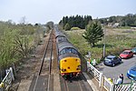
Thorpe St Andrew is a town and civil parish in the Broadland district of Norfolk, England. It is situated on the River Yare, two miles east of the centre of Norwich, and is outside the boundary of the city. The civil parish has an area of 708 ha (1,750 acres) and had a population of 14,556 at the 2011 census; this was an increase from the 2001 figure of 13,762. It is the administrative headquarters of the Broadland district council.
Excerpt from the Wikipedia article Thorpe St Andrew (License: CC BY-SA 3.0, Authors, Images).Thorpe St Andrew
Brenda James Close, Broadland Thorpe St Andrew
Geographical coordinates (GPS) Address Website Nearby Places Show on map
Geographical coordinates (GPS)
| Latitude | Longitude |
|---|---|
| N 52.63545 ° | E 1.3431 ° |
Address
The Church of the Good Shepherd
Brenda James Close
NR7 0LH Broadland, Thorpe St Andrew
England, United Kingdom
Open on Google Maps


