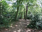
RAF Mousehold Heath

The area of Norwich between the Salhouse and Plumstead roads (outside of the outer ring road) was originally the Cavalry Training Ground and then became the Royal Flying Corps Mousehold Heath aerodrome where Boulton Paul, among other manufacturers, passed over the aircraft they made for service. It was sometimes known as Norwich aerodrome by the Royal Flying Corps before it became Royal Air Force Mousehold Heath in April 1918. After the First World War, Boulton and Paul continued to use the site. The Norwich & Norfolk Aero Club was formed at the airfield in 1927 which then became the first Norwich Airport in 1933. The airfield fell into disuse during the Second World War and has now mostly been redeveloped for housing.
Excerpt from the Wikipedia article RAF Mousehold Heath (License: CC BY-SA 3.0, Authors, Images).RAF Mousehold Heath
Frere Road, Norwich Heartsease
Geographical coordinates (GPS) Address Phone number Website Nearby Places Show on map
Geographical coordinates (GPS)
| Latitude | Longitude |
|---|---|
| N 52.643333333333 ° | E 1.3338888888889 ° |
Address
Frere Road Community Centre
Frere Road
NR7 9UT Norwich, Heartsease
England, United Kingdom
Open on Google Maps


