place

Combe Fields

Borough of RugbyCivil parishes in WarwickshireWarwickshire geography stubs
Coombe Abbey and Country Park, aerial 2018, geograph 5845962 by Simon Tomson

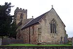
Combe Fields is a civil parish in the Rugby district, in the county of Warwickshire, England. The parish has no village, but contains Coombe Abbey, after which it is named, and a few isolated houses. In the 2001 census the parish had a population of 114 increasing to 126 at the 2011 census.The parish also contains Ansty Park, a business park where Cadent Gas and the London Electric Vehicle Company have their headquarters. At the time of the Domesday Book the parish was called Smite, which contained two settlements of Upper and Lower Smite; these were both deserted in the 12th or 13th century when Monks from Coombe Abbey enclosed them to create sheep pastures. The old parish name is retained in Smite Brook, Smeeton Lane and Smite Hill. The remains of the medieval church of St Peter of Lower Smite was converted into a house called Peter Hall in the 16th century.

Excerpt from the Wikipedia article Combe Fields (License: CC BY-SA 3.0, Authors, Images).

Combe Fields
Combe Fields Road,

Geographical coordinates (GPS) Address Nearby Places
placeShow on map

Wikipedia: Combe FieldsContinue reading on Wikipedia

Geographical coordinates (GPS)

Latitude Longitude
N 52.42 ° E -1.4 °
placeShow on map

Address

Combe Fields Road

Combe Fields Road
CV7 9SR , Combe Fields CP
England, United Kingdom
mapOpen on Google Maps

Coombe Abbey and Country Park, aerial 2018, geograph 5845962 by Simon Tomson
Share experience

Nearby Places

Brandon, Warwickshire

Brandon is a small village in Warwickshire, England. Along with nearby Bretford, it forms part of a joint civil parish of Brandon and Bretford. Administratively it is part of the borough of Rugby. The River Avon passes just to the east of the village. Brandon is located upon the A428 road between Coventry, 5 miles (8.0 km) to the west, and Rugby, 6 miles (9.7 km) to the east. Just 1.5 miles (2.4 km) west of Brandon is the suburban village of Binley Woods and 1.5 miles (2.4 km) to the east is the hamlet of Bretford. Brandon is separated from the much larger village of Wolston by a railway viaduct, but the two villages practically form a single entity. The railway viaduct dates from 1837 and was part of the original London and Birmingham Railway, which is now part of the Rugby–Birmingham–Stafford Line, which runs across the parish; Brandon and Wolston railway station operated here until 1960.The village contains a number of old cottages and has a pub near the railway line. Just to the north of the village is Brandon Stadium, also known as the Coventry Stadium, which was used for speedway racing, greyhound racing, and stock car racing before being sold with the intention of house-building on the site. The stadium was home to the Coventry Bees speedway team. West of the village is Brandon Marsh, a 228-acre (0.92 km2) nature reserve with a wide variety of wildlife, especially pondlife. The reserve's visitor centre was opened in 1998 by Sir David Attenborough. Also to the west and north of Brandon Marsh is Brandon Wood, a community woodland owned and managed by a local group the Friends Of Brandon Wood. A grassy mound marks the remains of Brandon Castle, which is found to the south of the village. The castle was built in the 12th century by the de Verdon family. It was garrisoned in 1195, but was relatively short lived, as it was said to have been ‘pulled down’ in 1265 by the baronial troops from Kenilworth Castle, because John de Verdon was an active supporter of the king.

Shilton, Warwickshire

Shilton is a village in the civil parish of Shilton and Barnacle in the English county of Warwickshire. The village is about 5.5 miles (8.9 km) northeast of Coventry on the B4065 road and at a crossroads with the B4029 road, and is the same distance southwest of Hinckley. Administratively, Shilton is in an outlying part of the Borough of Rugby, although it is more than eight miles (13 km) northwest of the town of Rugby. Shilton is almost cut in two by the Trent Valley railway line (part of the West Coast Main Line). The village formerly had its own railway station on this line which opened in 1847, and closed in 1957. A short distance to the northwest of the village is the M69 motorway. The village contains a number of old cottages along the main street which were historically occupied by weavers, a village hall and one old pub, the "Shilton Arms", historically there was a second pub called the "Old Plough".The village was mentioned in the Domesday Book of 1086 as “Scelftone”, and was recorded as having eight households. The parish church of St Andrew's has existed since the 13th century, but was rebuilt twice in the 14th and 15th centuries. A second north aisle was added in 1865, and was designed by Sir George Gilbert Scott. The graveyard has some elaborately carved 18th century gravestones. There is also a small baptist chapel in the village which dates from 1867.Leicester Road is just past the Shilton arms. Leicester Road contains a farm which field lies next to the Shilton Arms garden. As you enter Leicester Road on the left hand side there is a white house which used to be a pub too but was converted into a house in 2002.