Burgh Walls Camp
Hill forts in SomersetHistory of SomersetIron Age sites in SomersetScheduled monuments in North Somerset
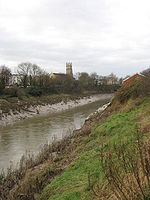
Burgh Walls Camp is a multivallate Iron Age hill fort in the North Somerset district of Somerset, England. The hill fort is situated within Leigh Woods approximately 1.6 miles (2.6 km) north-east from the village of Long Ashton near Bristol, above the banks of the River Avon. The hillfort has some alternative names such as Bower Walls Camp, Burwalls, or Bowre Walls. Burgh Walls Camp is one of three Iron Age fortifications overlooking the Avon Gorge, the others being Stokeleigh Camp and Clifton Camp on the opposite side of the gorge, on Clifton Down near the Observatory.
Excerpt from the Wikipedia article Burgh Walls Camp (License: CC BY-SA 3.0, Authors).Burgh Walls Camp
Dead Badger's Bottom,
Geographical coordinates (GPS) Address Nearby Places Show on map
Geographical coordinates (GPS)
| Latitude | Longitude |
|---|---|
| N 51.451944444444 ° | E -2.6294444444444 ° |
Address
Dead Badger's Bottom
Dead Badger's Bottom
BS8 3PT , Hotwells
England, United Kingdom
Open on Google Maps


