Derwenthorpe
Use British English from June 2014Villages and areas in the City of York

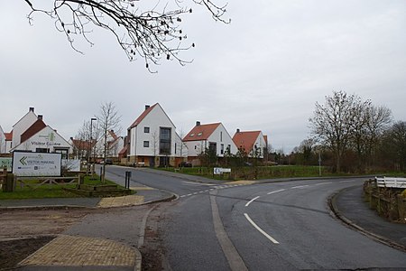
Derwenthorpe is a housing development situated approximately 2 miles (3.2 km) to the east of York city centre which is adjacent to Osbaldwick, Tang Hall and Meadlands. The design and planning for this new estate was undertaken by the Joseph Rowntree Housing Trust (JRHT) and the building contract for all four build phases has been awarded to Barratt Developments (under the brand name "David Wilson Homes").The original name of "New Osbaldwick" was dropped in favour of "Derwenthorpe" in 2004 in reference to the Derwent Valley Light Railway that used to run through the site.
Excerpt from the Wikipedia article Derwenthorpe (License: CC BY-SA 3.0, Authors, Images).Derwenthorpe
Derwent Way,
Geographical coordinates (GPS) Address Nearby Places Show on map
Geographical coordinates (GPS)
| Latitude | Longitude |
|---|---|
| N 53.959906 ° | E -1.038749 ° |
Address
Derwent Way
Derwent Way
YO10 3BF
England, United Kingdom
Open on Google Maps


