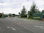
Keresley
Keresley is a suburban village and civil parish in the City of Coventry, West Midlands, England, about 4.5 miles (7 km) north of Coventry city centre and 3.5 miles (6 km) southwest of Bedworth. According to the 2001 census, the parish had a population of 791 falling to 713 at the 2011 Census, although the 2018 population was estimated at 783.Keresley and Keresley End are two separate areas; Keresley is in Coventry, while the slightly more rural Keresley End, also known as Keresley Village or Keresley Newlands, is in Warwickshire, with the exception of Thompsons Road in the village, which lies within the Coventry boundary. The village features two grocers shops, two bus stops, a beauty salon, primary school, doctors surgery, a fish and chip shop, a small church, a post office, library, park, garden centre and community centre.
Excerpt from the Wikipedia article Keresley (License: CC BY-SA 3.0, Authors).Keresley
Copthorne Road, Coventry Coundon
Geographical coordinates (GPS) Address Nearby Places Show on map
Geographical coordinates (GPS)
| Latitude | Longitude |
|---|---|
| N 52.433333333333 ° | E -1.5333333333333 ° |
Address
Copthorne Lodge
Copthorne Road
CV6 2EE Coventry, Coundon
England, United Kingdom
Open on Google Maps


