Rolava
Czech Republic river stubsRivers of the Karlovy Vary RegionRivers of the Ore MountainsTributaries of the Ohře

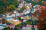
The Rolava (German: Rohlau) is a left tributary of the Ohře river in the northwest of the Czech Republic. It is 36.7 kilometres (22.8 mi) long, and its basin area is 138 square kilometres (53 sq mi).It rises in the Czech part of the Ore Mountains near the border with Germany, in the territory of Přebuz. North of its source is the raised bog of Großer Kranichsee, whose waters the Rolava partly collects. During its course in a mainly southeasterly direction the river flows between Vysoká Pec and Nové Hamry, then through Nejdek, Smolné Pece and Nová Role. It then flows through Karlovy Vary from northwest to southeast and discharges into the Ohře.
Excerpt from the Wikipedia article Rolava (License: CC BY-SA 3.0, Authors, Images).Rolava
6;222, Karlovy Vary Rybáře
Geographical coordinates (GPS) Address Nearby Places Show on map
Geographical coordinates (GPS)
| Latitude | Longitude |
|---|---|
| N 50.2323 ° | E 12.8457 ° |
Address
6;222
360 05 Karlovy Vary, Rybáře
Northwest, Czechia
Open on Google Maps


