St Buryan

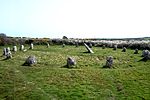
St Buryan (Cornish: Pluwveryan) is a village and former civil parish, now in the parish of St Buryan, Lamorna and Paul in Cornwall, England, United Kingdom. In 2011 the parish had a population of 1412. The village of St Buryan is situated approximately 5 miles (8.0 km) west of Penzance along the B3283 towards Land's End. Three further minor roads also meet at St Buryan, two link the village with the B3315 towards Lamorna, and the third rejoins the A30 at Crows-an-Wra.St Buryan parish encompassed the villages of St. Buryan, Lamorna, and Crows-an-Wra and shared boundaries with the parishes of Sancreed and St Just to the north, Sennen and St Levan (with which it has close ties) to the west, with Paul to the east and by the sea in the south. An electoral parish also exists stretching from Land's End to the north coast but avoiding St Just. The population of this ward at the 2011 census was 4,589.Named after the Irish Saint Buriana, the parish is situated in an area of outstanding natural beauty and is a popular tourist destination. It has been a designated conservation area since 1990 and is near many sites of special scientific interest in the surrounding area. The parish is dotted with evidence of Neolithic activity, from stone circles and Celtic crosses to burial chambers and ancient holy wells. The village of St Buryan itself is also a site of special historic interest, and contains many listed buildings including the famous grade I listed church. The bells of St Buryan's Church, which have recently undergone extensive renovation, are the heaviest full circle peal of six anywhere in the world. The parish also has a strong cultural heritage. Many painters of the Newlyn School including Samuel John "Lamorna" Birch were based at Lamorna in the south-east of the parish. St Buryan Village Hall was also the former location of Pipers Folk Club, created in the late 1960s by celebrated Cornish singer Brenda Wootton.
Excerpt from the Wikipedia article St Buryan (License: CC BY-SA 3.0, Authors, Images).St Buryan
Newlyn Road,
Geographical coordinates (GPS) Address Nearby Places Show on map
Geographical coordinates (GPS)
| Latitude | Longitude |
|---|---|
| N 50.075 ° | E -5.621 ° |
Address
Newlyn Road
Newlyn Road
TR19 6DS , St Buryan, Lamorna and Paul
England, United Kingdom
Open on Google Maps


