place

Brane Barrow

Barrows in EnglandBuildings and structures in CornwallMegalithic monuments in EnglandPrehistoric sites in CornwallReligion in Cornwall
Tourist attractions in Cornwall
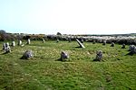
Brane burial chamber geograph.org.uk 1040

Brane Barrow, or Chapel Euny Barrow, is a Neolithic entrance grave located near the hamlet of Brane, Cornwall, England, UK. It is considered to be one of the smallest and best preserved burial monuments in Britain.

Excerpt from the Wikipedia article Brane Barrow (License: CC BY-SA 3.0, Authors, Images).

Geographical coordinates (GPS)

Latitude Longitude
N 50.0968 ° E -5.635 °
placeShow on map

Address

Cardinney Car. & Camp Park


TR19 6HX , St Buryan, Lamorna and Paul
England, United Kingdom
mapOpen on Google Maps

Brane burial chamber geograph.org.uk 1040
Share experience

Nearby Places

Bartinney Castle
Bartinney Castle

Bartinney Castle is an Iron Age enclosure located in the Penwith Peninsula of Southwest Cornwall, England, it is surrounded by a circular earthwork standing on a hill surrounded by various archaeological prehistoric remains, including ancient settlements, field systems, tumuli and cairns. One mile to the southwest is Carn Brea, the westernmost hill in Britain; and a mile to the southeast is Carn Euny Iron Age village and fogou, and the neighbouring Caer Bran hillfort and Sancreed Beacon.On the hilltop are the remains of a circular bank, about 250 feet across, and an encircling ditch. This bank may have been much higher and there are suggestions the site could have been a sacred enclosure or Plen an Gwarry, which was a type of amphitheatre with rows of stone seats where feast days or fire festivals celebrating the Celtic solar god, Belenos, were held or where mystery plays were staged. Other theories suggest a large disc barrow or an unfinished hill fort; the outer wall is not high enough to have been of any defensive value. In the centre of the enclosure are three smaller circles arranged in a triangle, originally made of contiguous stones which have since been removed. The largest of these is forty feet in diameter; the other two are about 25 and 30 feet across.Local parish records suggest that Bartinney Castle was the site of a Celtic fire festival marking the harvest or Samhain, the Celtic New Year's Day. The name Bartinè signifies the lighted eminence, or the hill of fires (Cornish - Bretanow). The Druids, it is said, had their fires on the eve of November, when the people were obliged to resort and re-kindle the private fires in their houses from the consecrated fires of the Druids, the domestic fire having been first carefully extinguished. On Midsummer's Day, in recent times, the inhabitants, of this parish were greeted with sounds resembling the discharge of musketry in different directions, proceeding from holes bored in rocks, which being charged with powder were exploded in succession; and on the same day a new flag was displayed on every mine, and the night was ushered in with noisy festivities, and bonfires blazing on many of the hills.The name may also be derived from Tinne, the Druid name for the holly tree, the burning of which was associated with the death of the old year and the coming of the new one on Samhain or 31 October. Tinne also means a metal ingot or iron bar according to the Bríatharogam.

St Buryan
St Buryan

St Buryan (Cornish: Pluwveryan) is a village and former civil parish, now in the parish of St Buryan, Lamorna and Paul in Cornwall, England, United Kingdom. In 2011 the parish had a population of 1412. The village of St Buryan is situated approximately 5 miles (8.0 km) west of Penzance along the B3283 towards Land's End. Three further minor roads also meet at St Buryan, two link the village with the B3315 towards Lamorna, and the third rejoins the A30 at Crows-an-Wra.St Buryan parish encompassed the villages of St. Buryan, Lamorna, and Crows-an-Wra and shared boundaries with the parishes of Sancreed and St Just to the north, Sennen and St Levan (with which it has close ties) to the west, with Paul to the east and by the sea in the south. An electoral parish also exists stretching from Land's End to the north coast but avoiding St Just. The population of this ward at the 2011 census was 4,589.Named after the Irish Saint Buriana, the parish is situated in an area of outstanding natural beauty and is a popular tourist destination. It has been a designated conservation area since 1990 and is near many sites of special scientific interest in the surrounding area. The parish is dotted with evidence of Neolithic activity, from stone circles and Celtic crosses to burial chambers and ancient holy wells. The village of St Buryan itself is also a site of special historic interest, and contains many listed buildings including the famous grade I listed church. The bells of St Buryan's Church, which have recently undergone extensive renovation, are the heaviest full circle peal of six anywhere in the world. The parish also has a strong cultural heritage. Many painters of the Newlyn School including Samuel John "Lamorna" Birch were based at Lamorna in the south-east of the parish. St Buryan Village Hall was also the former location of Pipers Folk Club, created in the late 1960s by celebrated Cornish singer Brenda Wootton.