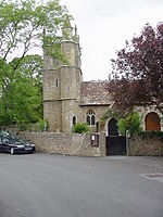
Dinghurst fort
Buildings and structures in North SomersetHill forts in SomersetScheduled monuments in North SomersetSomerset geography stubs
Dinghurst fort is an Iron Age univallate hillfort south of Churchill in Somerset, England. A scarp encircles the camp, 2.0 metres (6.5 ft) high in the east and 3.0 metres (9.8 ft) high in the west. The fort is also surrounded by a fosse. Bones, rings, and weapons have been found inside the fort.
Excerpt from the Wikipedia article Dinghurst fort (License: CC BY-SA 3.0, Authors).Dinghurst fort
The Batch,
Geographical coordinates (GPS) Address Nearby Places Show on map
Geographical coordinates (GPS)
| Latitude | Longitude |
|---|---|
| N 51.32872 ° | E -2.798669 ° |
Address
The Batch
The Batch
BS25 5NS
England, United Kingdom
Open on Google Maps


