Clausnitz
Mittelsachsen

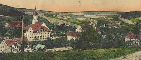
Clausnitz is a village in the municipality of Rechenberg-Bienenmühle in the Saxon district of Mittelsachsen in Germany. It lies in the Eastern Ore Mountains, in the valley of the Rachel, a tributary of the Freiberger Mulde. Clausnitz emerged during the clearings of the 12th century. It is a typical Waldhufendorf, that has preserved its tidy, village character today with its rural two- and three-sided farmsteads and timber-framed houses.
Excerpt from the Wikipedia article Clausnitz (License: CC BY-SA 3.0, Authors, Images).Clausnitz
Dorfstraße,
Geographical coordinates (GPS) Address Nearby Places Show on map
Geographical coordinates (GPS)
| Latitude | Longitude |
|---|---|
| N 50.739722222222 ° | E 13.492222222222 ° |
Address
Dorfstraße 70
09623
Saxony, Germany
Open on Google Maps


