Montour Trail
Geographic coordinate listsLists of coordinatesNational Recreation Trails in PennsylvaniaProtected areas of Allegheny County, PennsylvaniaRail trails in Pennsylvania

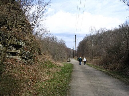
The Montour Trail is a multi-use recreational rail trail near Pittsburgh, Pennsylvania. It was formerly the Montour Railroad. It has a mostly crushed limestone with partially asphalt surface, appropriate for bicycling, walking, running, and cross-country skiing. Eventually, this trail segment will extend 47 miles (76 km) from Coraopolis, Pennsylvania to Clairton, Pennsylvania. The trail is part of a 204-mile (328 km) rails to trails project between Pittsburgh and Cumberland, Maryland that makes up part of a 400-mile (640 km) trail system between Pittsburgh and Washington, D.C., known as the Great Allegheny Passage.
Excerpt from the Wikipedia article Montour Trail (License: CC BY-SA 3.0, Authors, Images).Montour Trail
Montour Trail, Cecil Township
Geographical coordinates (GPS) Address Nearby Places Show on map
Geographical coordinates (GPS)
| Latitude | Longitude |
|---|---|
| N 40.3181 ° | E -80.2281 ° |
Address
Montour Trail
Montour Trail
15361 Cecil Township
Pennsylvania, United States
Open on Google Maps


