Colinton
Areas of EdinburghParishes formerly in MidlothianUse British English from June 2017Villages in Edinburgh council area

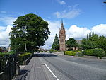
Colinton (Scottish Gaelic: Baile Cholgain) is a suburb of Edinburgh, Scotland situated 3+1⁄2 miles (5.6 km) south-west of the city centre. Up until the late 18th century it appears on maps as Collington. It is bordered by Dreghorn to the south and Craiglockhart to the north-east. To the north-west it extends to Lanark Road (the A70) and to the south-west to the City Bypass. Bonaly is a subsection of the area on its southern side. Colinton is a designated conservation area.
Excerpt from the Wikipedia article Colinton (License: CC BY-SA 3.0, Authors, Images).Colinton
Redford Road, City of Edinburgh Colinton
Geographical coordinates (GPS) Address Nearby Places Show on map
Geographical coordinates (GPS)
| Latitude | Longitude |
|---|---|
| N 55.908333333333 ° | E -3.25 ° |
Address
Old Farm Court
Redford Road
EH13 0AA City of Edinburgh, Colinton
Scotland, United Kingdom
Open on Google Maps


