Pitt Lake

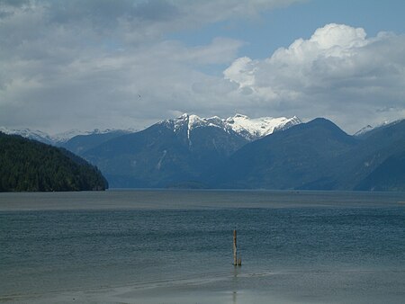
Pitt Lake is the second-largest lake in the Lower Mainland of British Columbia. About 53.5 km2 (20.7 sq mi) in area, it is about 25 km (16 mi) long and about 4.5 km (2.8 mi) wide at its widest. It is one of the world's relatively few tidal lakes, and among the largest. In Pitt Lake, there is on average a three-foot tide range; thus Pitt Lake is separated from sea level and tidal waters during most hours of each day during the 15 foot tide cycle of the Pitt River and Strait of Georgia estuary immediately downstream. The lake's southern tip is 20 km (12 mi) upstream from The Pitt River confluence with the Fraser River and is 40 km (25 mi) east of Downtown Vancouver.
Excerpt from the Wikipedia article Pitt Lake (License: CC BY-SA 3.0, Authors, Images).Pitt Lake
Area F (McConnell Creek/Hatzic Prairie)
Geographical coordinates (GPS) Address Nearby Places Show on map
Geographical coordinates (GPS)
| Latitude | Longitude |
|---|---|
| N 49.416666666667 ° | E -122.55 ° |
Address
V5R 5T5 Area F (McConnell Creek/Hatzic Prairie)
British Columbia, Canada
Open on Google Maps


