place

Kilbucho

Parishes in PeeblesshirePeeblesshireScottish Borders geography stubsVillages in the Scottish Borders
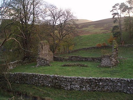
Kilbucho Church
Kilbucho Church

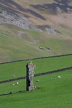
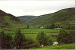
Kilbucho (Scottish Gaelic: Cille Bheagha) is a small settlement in the parish of Broughton, Glenholm and Kilbucho in the Scottish Borders area of Scotland in Peeblesshire and near Biggar and Broughton. The name derives from the church which was dedicated to St Bega an Irish abbess. Several monasteries were dedicated to St Bega, many in Cumbria including St Bees but also in Scotland at Kilbagie in Clackmannanshire and Kilbegie in Argyllshire. Near the church is St Bees wellThe former parish of Kilbucho, now united in Broughton, Glenholm and Kilbucho, has an area of 6,710 acres. It forms a valley between Cardon Hill on the south and Hartree Hills on the north, however the land is mainly level with a very slight inclination towards Biggar Water. Kilbucho is "fenced" in by hills on three sides, including some of the highest in southern Scotland east of Galloway. Coulter Fell is near here. The manors of Kilbucho and Thriepland are mentioned in writs of 13th century.The area is strongly connected with John Buchan, the author of The Thirty Nine Steps and former governor general of Canada. It is thought that the inspiration for his 1927 novel Witch Wood comes from this particular area.

Excerpt from the Wikipedia article Kilbucho (License: CC BY-SA 3.0, Authors, Images).

Geographical coordinates (GPS)

Latitude Longitude
N 55.6018 ° E -3.4458 °
placeShow on map

Address


ML12 6JG
Scotland, United Kingdom
mapOpen on Google Maps

Kilbucho Church
Kilbucho Church
Share experience

Nearby Places

Broughton, Glenholm and Kilbucho

Broughton, Glenholm and Kilbucho is a parish in Peeblesshire in the Scottish Borders, 11 miles south-west of Peebles, lying in the upper part of the valley of the River Tweed in the Southern Uplands. It is a union of three former parishes of bearing these names and the united parish is bound by Kirkurd on the north, Stobo on the east, Drumelzier on the south-east, Culter and Biggar, South Lanarkshire on the west and by Skirling in the north-west. For 4½ miles the eastern border of the parish follows the northward flowing Tweed. It is 9½ miles long north-to-south and 3½ miles wide. The only village is Broughton. This parish comprehends the old parish of Broughton in the north, and Glenholm in the south-east and Kilbucho on the south-west. In accordance with the deed of annexation, all three names are retained in the name of the united parish. Biggar Water, which forms the boundary between the Broughton and the other two, flows in an easterly direction and, before joining the Tweed, is joined in turn by Kilbucho Burn, Broughton Burn and Holms Water, each of which forms valleys containing the parishes that bear their names.The origin of the name Glenholm is obviously the valley of the Holms. Kilbucho, also spelled Kilbeuhhoe, Kilbochoe, Kilbocho, and Kirkbucho, is probably the Gaelic prefix "Kil" meaning chapel together with the name of the Venerable Bede or St Bega or St Bees. "Brough" in Broughton may refer to "burgh" or more likely the Scots term Brough or Bruch, meaning circle, of hills.The united parish was established by the Presbytery of Biggar in 1794 and a new church was built in 1804 at a convenient central location for the united parish. While within Kilbucho, the church is located just south of the village of Broughton and across Biggar Water. It is now a member of the linked "Parishes of Upper Tweeddale". Which is made up of the four linked Parishes of: Broughton, Glenholm and Kilbucho Skirling Stobo and Drumelzier Tweedsmuir At the time the three old parishes were united their area and population was : At the same time the north-west portion of Kilbucho, around Hartree and Hartree Hills, was transferred to the parish of Culter in Lanarkshire, although this portion remained in Peeblesshire. This had an area of 1712 acres. However this portion was returned to the united parish in 1891, so that Culter became a parish entirely within Lanarkshire.For some time the three parishes continued to exist for some civil purposes. They continued as Registration Districts until 1870 and to have separate parish schools.The civil parish of Broughton, Glenholm and Kilbucho is covered by the Upper Tweed Community Council (which also includes part of Drumelzier).The civil parish has a population of 648 (in 2011) and its area is 19,797 acres.

Skirling
Skirling

Skirling is a parish, community council area and village in Peeblesshire in the Scottish Borders situated 2+1⁄2 miles east of Biggar in Lanarkshire. Biggar Water, a tributary the River Tweed forms the southern boundary of the parish with the parish of Broughton, Glenholm and Kilbucho. It is also bounded by that parish on the east, namely the Broughton part of it. On the north it is bounded by the parish Kirkurd in Peeblesshire. Spittal Burn forms most of its western boundary with Lanarkshire. The parish lies in the Southern Uplands. Its village is 690 ft above sea level. Its length, north to south, is 3 miles and it is 2 miles at most wide. The highest point in the parish is Broomy Law, 1399 ft, on the north-west boundary. At its northernmost point the parish is met by 5 other parishes (boundary stone at site). The earliest known record of Skirling by name dates from the reign of King Robert Bruce, who granted the barony of Scrawline to John Monfode. The barony of Skirling was possessed by the Cockburn family c.1370 - 1621 and during the 18th and 19th centuries by the Carmichael family. Thomas Gibson-Carmichael was raised to peerage of the United Kingdom in 1912 as Baron Carmichael of Skirling, but this title became extinct on his death in 1926. He commissioned the building of Skirling House in 1905. The earliest record of a church is in 1275, sited near the present war memorial. Former ministers include John Greig. In 1843, William Hanna left the established Church of Scotland in 1843, joining the Free Church of Scotland, taking most of his congregation with him. The present building was rebuilt in 1720 and was much altered in 1891. It has a pleasant bell tower with a sundial, the bell dating from 1748. Ironwork on the graveyard gates is by Thomas Hadden and the Carmichael family plot is flanked by two charming angel sculptures. The church is now a member of the linked "Parishes of Upper Tweeddale", which is made up of four neighbouring Parishes.The Skirling Community Council area is the same as the civil parish. The council has 6 members.The village of Skirling has a central position in the parish. It originally consisted of five small farms on the valley floor of Skirling Burn, forming a roughly linear shaped settlement. The village is a conservation area, which includes the parish church, the old Free church, Skirling House, along with many 1 - 2 story buildings made from traditional materials. Just south-west of the village is the site of Skirling Castle, described as "ane notable beilding" and demolished and burnt by Regent Moray on 12 June 1568.The village war memorial was designed by Sir Robert Lorimer and added in 1920.The civil parish has a population of 194 (in 2011) and its area is 3,423 acres.At 11.18am on 31 December 2020 Skirling was the epicentre of a 1.9 Magnitude earthquake which was also felt in Biggar, Symington, West Linton and Peebles. Locals reported that they heard a "loud bang" or "loud rumbling noise" and that the "room shuddered".