place

Mossfennan

Scottish Borders geography stubsVillages in the Scottish Borders
Mossfennan geograph.org.uk 16602

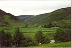
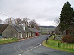
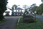
Mossfennan is a small settlement in southern Scotland near Drumelzier in the Scottish Borders, in the valley of the River Tweed. Mossfennan is a wooded area part of the parish of Glenholm. There was once a peel tower at Mossfennan. Also near Mossfennan are the remains of a Bronze Age burial cairn. When the Talla Railway was built there was a spectacular overhead sheep crossing at Mossfennan which consisted of six concrete piers and a long ramps at right angles to the railway track. Mossfennan appears in literature being referenced in an old Scottish ballad. 'The King rode round the Merecleuch Head, Wi' spotted hounds and spaniels three, Then lichted doun at Mossfennan Yett, A little below the Logan Lee.'John Veitch also describes the locality in The Hart of Mossfennan

Excerpt from the Wikipedia article Mossfennan (License: CC BY-SA 3.0, Authors, Images).

Geographical coordinates (GPS)

Latitude Longitude
N 55.5707 ° E -3.4012 °
placeShow on map

Address

A701
ML12 6QH
Scotland, United Kingdom
mapOpen on Google Maps

Mossfennan geograph.org.uk 16602
Share experience

Nearby Places

Broughton, Glenholm and Kilbucho

Broughton, Glenholm and Kilbucho is a parish in Peeblesshire in the Scottish Borders, 11 miles south-west of Peebles, lying in the upper part of the valley of the River Tweed in the Southern Uplands. It is a union of three former parishes of bearing these names and the united parish is bound by Kirkurd on the north, Stobo on the east, Drumelzier on the south-east, Culter and Biggar, South Lanarkshire on the west and by Skirling in the north-west. For 4½ miles the eastern border of the parish follows the northward flowing Tweed. It is 9½ miles long north-to-south and 3½ miles wide. The only village is Broughton. This parish comprehends the old parish of Broughton in the north, and Glenholm in the south-east and Kilbucho on the south-west. In accordance with the deed of annexation, all three names are retained in the name of the united parish. Biggar Water, which forms the boundary between the Broughton and the other two, flows in an easterly direction and, before joining the Tweed, is joined in turn by Kilbucho Burn, Broughton Burn and Holms Water, each of which forms valleys containing the parishes that bear their names.The origin of the name Glenholm is obviously the valley of the Holms. Kilbucho, also spelled Kilbeuhhoe, Kilbochoe, Kilbocho, and Kirkbucho, is probably the Gaelic prefix "Kil" meaning chapel together with the name of the Venerable Bede or St Bega or St Bees. "Brough" in Broughton may refer to "burgh" or more likely the Scots term Brough or Bruch, meaning circle, of hills.The united parish was established by the Presbytery of Biggar in 1794 and a new church was built in 1804 at a convenient central location for the united parish. While within Kilbucho, the church is located just south of the village of Broughton and across Biggar Water. It is now a member of the linked "Parishes of Upper Tweeddale". Which is made up of the four linked Parishes of: Broughton, Glenholm and Kilbucho Skirling Stobo and Drumelzier Tweedsmuir At the time the three old parishes were united their area and population was : At the same time the north-west portion of Kilbucho, around Hartree and Hartree Hills, was transferred to the parish of Culter in Lanarkshire, although this portion remained in Peeblesshire. This had an area of 1712 acres. However this portion was returned to the united parish in 1891, so that Culter became a parish entirely within Lanarkshire.For some time the three parishes continued to exist for some civil purposes. They continued as Registration Districts until 1870 and to have separate parish schools.The civil parish of Broughton, Glenholm and Kilbucho is covered by the Upper Tweed Community Council (which also includes part of Drumelzier).The civil parish has a population of 648 (in 2011) and its area is 19,797 acres.

Crook Inn
Crook Inn

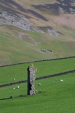
The Crook Inn is an inn in the Scottish Borders, near the village of Tweedsmuir on the A701 road between Broughton and Moffat. It is one of many claimants to be the oldest inn in Scotland. It was licensed in 1604. Robert Burns wrote "Willie Wastle's Wife" there. It has served as a coaching inn, a Post Office and source of employment. In the early 20th century a halt was built on the Talla Railway to serve it. The inn attracted much passing trade from the labourers who were building the Talla Reservoir, which the railway was built to serve. The hotel was refurbished in 1936 in the then-current Art Deco style, and retains many of the features installed at that time. It has also, over the years, become a place of pilgrimage for members of the Porteous family, visiting the site of nearby Hawkshaw, their former ancestral home on the hills above Tweeddale and the Fruid Reservoir. A reunion of Porteous family members was traditionally held at the inn every five years, attracting visitors from all over the world. The proposals to convert the historic inn into apartments met with much local opposition and the plans were rejected by the councillors of Tweeddale West in March 2008. Following refusal the present owner lodged an appeal with the Department for Planning and Environmental Appeals (DPEA), a department of the Scottish Government. On 2 February 2009, following an appeal hearing on 18 November 2008, a decision notice was issued by the DPEA which finally dismissed the appeal. This meant that planning permission was not granted for the change of use of the historic Crook Inn to residential accommodation, giving scope for the inn to reopen once again if it could be purchased. In January 2013, after a lengthy campaign by the Tweedsmuir community to secure ownership of the Crook Inn in order to reinvigorate it, the Tweedsmuir Community Company raised the asking price of £160,000 and bought the property. The Tweedsmuir Community Company obtained a Development Grant from Big Lottery in 2014 to redesign and renovate the historic Crook Inn, with designs undertaken by WTArchitecture, Edinburgh. The plans obtained planning permission in 2015. The rest of the land at the site was purchased in 2015 with grants from the Scottish Land Fund, SSE Clyde Border and the Infinis Glenkerie Community Funds. Grants are being sought to create a multi-faceted Crook Inn Community Hub to serve the Upper Tweed community and tourism. Since then nothing has happened and the building continues to deteriorate. It is listed on the Buildings at Risk Register for Scotland.