Brookfield Air Force Station
1952 establishments in Ohio1959 disestablishments in OhioAerospace Defense Command military installationsBuildings and structures in Trumbull County, OhioGeographic coordinate lists ... and 6 more
Installations of the United States Air Force in OhioLists of coordinatesMilitary installations closed in 1959Military installations established in 1952Radar stations of the United States Air ForceUse American English from January 2024

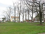
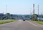
Brookfield Air Force Station is a closed United States Air Force General Surveillance Radar station. It is located 1.1 miles (1.8 km) south-southeast of Brookfield, Ohio. It was closed in 1959.
Excerpt from the Wikipedia article Brookfield Air Force Station (License: CC BY-SA 3.0, Authors, Images).Brookfield Air Force Station
County Highway 1162,
Geographical coordinates (GPS) Address Nearby Places Show on map
Geographical coordinates (GPS)
| Latitude | Longitude |
|---|---|
| N 41.219166666667 ° | E -80.561944444444 ° |
Address
County Highway 1162
44403
Ohio, United States
Open on Google Maps


