Halket Loch
Former lochsFreshwater lochs of ScotlandLochs of East AyrshireUse British English from August 2013

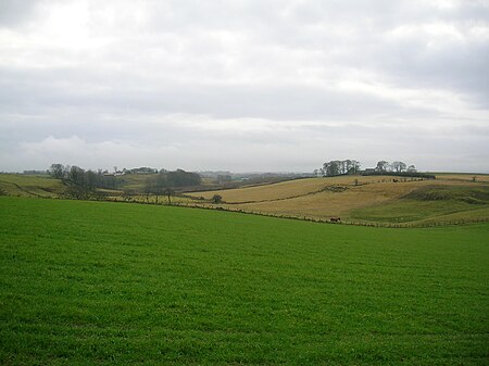
Halket Loch' also known as Halkhead or Halketh, was situated in the mid-Ayrshire clayland near Lugton. It is visible as a surface depression in pastureland, sometimes partially flooded, situated in a low-lying area close to farms and dwellings of East, North and Middle Halket and Craighead in the Parish of Dunlop, East Ayrshire, Scotland. The loch was natural, sitting in a hollow created by glaciation. The loch waters drained via the Glazert Water that joins the Annick Water.
Excerpt from the Wikipedia article Halket Loch (License: CC BY-SA 3.0, Authors, Images).Halket Loch
Geographical coordinates (GPS) Address Nearby Places Show on map
Geographical coordinates (GPS)
| Latitude | Longitude |
|---|---|
| N 55.73775 ° | E -4.5225833333333 ° |
Address
KA3 4EW
Scotland, United Kingdom
Open on Google Maps


