place

Smithton Low-Level Bridge

1986 establishments in PennsylvaniaBridges completed in 1986Bridges in Westmoreland County, PennsylvaniaBridges over the Youghiogheny RiverCantilever bridges in the United States
Girder bridges in the United StatesHistoric American Engineering Record in PennsylvaniaPennsylvania bridge (structure) stubsRoad bridges in Pennsylvania
Smithtonlowlevel
Smithtonlowlevel

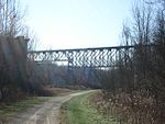
The Smithton Low-Level Bridge is a structure that carries Pennsylvania Route 981 across the Youghiogheny River between South Huntingdon Township and Rostraver Township, just south of Smithton, Pennsylvania. The previous structure on this site was a cantilever bridge built in 1900 to connect Smithton, which was then thriving due to its brewery, with residences on the west bank of the river; a state court ruled in favor of petitioners who demanded the creation of a bridge, but ordered that they contribute $1,200 in construction costs. Until the completion of the Smithton High-Level Bridge in 1956 (which eventually became part of busy Interstate 70), this structure was one of the most important vehicular crossings of the river. In 1986, the original bridge was replaced by a modern girder bridge.

Excerpt from the Wikipedia article Smithton Low-Level Bridge (License: CC BY-SA 3.0, Authors, Images).

Smithton Low-Level Bridge
PA 981,

Geographical coordinates (GPS) Address Nearby Places
placeShow on map

Wikipedia: Smithton Low-Level BridgeContinue reading on Wikipedia

Geographical coordinates (GPS)

Latitude Longitude
N 40.156944444444 ° E -79.744722222222 °
placeShow on map

Address

PA 981
15479
Pennsylvania, United States
mapOpen on Google Maps

Smithtonlowlevel
Smithtonlowlevel
Share experience

Nearby Places

Household No. 1 Site

The Household No. 1 Site is an archaeological site in Westmoreland County, Pennsylvania, United States. Located off Timms Lane in Rostraver Township, the site lies on a bluff above the Youghiogheny River.: 1, 2 Local archaeologists knew of the site in the early part of the twentieth century; the best records of the site are from amateur George Fisher, who studied the area from 1900 to 1950. More complete records were obtained after a 1980 investigation, which was part of the planning for the construction of baseball fields in the vicinity. Because archaeologists discovered a significant range of artifacts in the location, the fields were moved to allow for continued excavation. This investigation determined that the site was that of a Monongahela village.: 2 Evidence of warfare dominated the findings from the Household 1 Site. Many burials were present at the site — including sixteen at the site of one house alone — and projectile points composed a much larger percentage of the total findings than did domestic tools. Furthermore, the small total number of artifacts overall shows that the site was only occupied for a short period of time, and its location on a river bluff suggests that its site was chosen for defensibility. These discoveries, like those at many other Monongahela village sites, demonstrate that the Household residents lived in a highly martial culture.: 4 In 1986, the Household Site was added to the National Register of Historic Places for its archaeological significance.