Old City of Jerusalem

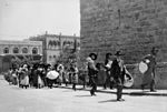
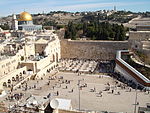
The Old City of Jerusalem (Hebrew: הָעִיר הָעַתִּיקָה, romanized: ha-ir ha-atiqah; Arabic: البلدة القديمة, romanized: al-Balda al-Qadimah; lit. 'the Old City') is a 0.9-square-kilometre (0.35 sq mi) walled area in East Jerusalem. The Old City is traditionally divided into four uneven quarters, namely: the Muslim Quarter, the Christian Quarter, the Armenian Quarter, and the Jewish Quarter. A fifth area, the Temple Mount, known to Muslims as the Haram al-Sharif, is home to the Dome of the Rock, Al-Aqsa Mosque and was once the site of two Jewish Temples. The current designations were introduced in the 19th century. The Old City's current walls and city gates were built by the Ottoman Empire from 1535 to 1542 under Suleiman the Magnificent. The Old City is home to several sites of key importance and holiness to the three major Abrahamic religions: the Temple Mount and Western Wall for Judaism, the Church of the Holy Sepulchre for Christianity, and the Dome of the Rock and al-Aqsa Mosque for Islam. The Old City, along with its walls, was added to the World Heritage Site list of UNESCO in 1981. In spite of its name, the Old City of Jerusalem's current layout is different from that of ancient times. Most archeologists believe that the City of David, an archaeological site on a rocky spur south of the Temple Mount, was the original settlement core of Jerusalem during the Bronze and Iron Ages. At times, the ancient city spread to the east and north, covering Mount Zion and the Temple Mount. The Old City as defined by the walls of Suleiman is thus shifted a bit northwards compared to earlier periods of the city's history, and smaller than it had been in its peak, during the late Second Temple period. The Old City's current layout has been documented in significant detail, notably in old maps of Jerusalem over the last 1,500 years. Until the mid-19th century, the entire city of Jerusalem (with the exception of David's Tomb complex) was enclosed within the Old City walls. The departure from the walls began in the 19th century, when the city's municipal borders were expanded to include Arab villages such as Silwan and new Jewish neighborhoods such as Mishkenot Sha'ananim. The Old City came under Jordanian control following the 1948 Arab-Israeli War. During the 1967 Six-Day War, Israel occupied East Jerusalem; since then, the entire city has been under Israeli control. Israel unilaterally asserted in its 1980 Jerusalem Law that the whole of Jerusalem was Israel's capital. In international law East Jerusalem is defined as territory occupied by Israel.
Excerpt from the Wikipedia article Old City of Jerusalem (License: CC BY-SA 3.0, Authors, Images).Old City of Jerusalem
Heil HaHandasa, Jerusalem Morasha
Geographical coordinates (GPS) Address External links Nearby Places Show on map
Geographical coordinates (GPS)
| Latitude | Longitude |
|---|---|
| N 31.776666666667 ° | E 35.234166666667 ° |
Address
העיר העתיקה
Heil HaHandasa
9511208 Jerusalem, Morasha
Jerusalem District, Israel
Open on Google Maps


