Chaddesley Corbett
EngvarB from June 2016Villages in Worcestershire

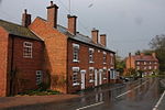
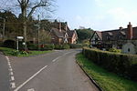
Chaddesley Corbett is a village and civil parish in the Wyre Forest District of Worcestershire, England. The Anglican and secular versions of the parish include other named neighbourhoods, once farmsteads or milling places: Bluntington, Brockencote, Mustow Green, Cakebole, Outwood, Harvington, and Drayton.
Excerpt from the Wikipedia article Chaddesley Corbett (License: CC BY-SA 3.0, Authors, Images).Chaddesley Corbett
Wyre Forest
Geographical coordinates (GPS) Address Nearby Places Show on map
Geographical coordinates (GPS)
| Latitude | Longitude |
|---|---|
| N 52.360725 ° | E -2.159672 ° |
Address
DY10 4SA Wyre Forest
England, United Kingdom
Open on Google Maps


