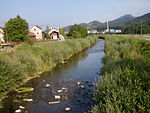
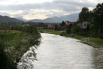
Dolenja Vas, Prebold
Pages with Slovene IPAPopulated places in the Municipality of PreboldSavinjska statistical region geography stubs
Dolenja Vas (pronounced [dɔˈleːnja ˈʋaːs]; Slovene: Dolenja vas) is a roadside settlement in the Municipality of Prebold in east-central Slovenia. The area is part of the traditional region of Styria. The municipality is now included in the Savinja Statistical Region.There are two small chapel-shrines in the settlement. One dates to 1725 and the other was built in the early 20th century.
Excerpt from the Wikipedia article Dolenja Vas, Prebold (License: CC BY-SA 3.0, Authors).Dolenja Vas, Prebold
Dolenja vas,
Geographical coordinates (GPS) Address Nearby Places Show on map
Geographical coordinates (GPS)
| Latitude | Longitude |
|---|---|
| N 46.240825 ° | E 15.089863888889 ° |
Address
Dolenja vas 96
3312
Slovenia
Open on Google Maps


