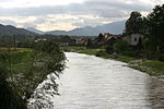
Šempeter v Savinjski Dolini
Pages with Slovene IPAPopulated places in the Municipality of ŽalecRoman sites in Slovenia

Šempeter v Savinjski Dolini (pronounced [ʃɛmˈpeːtəɾ ʍ saˈʋiːnski dɔˈliːni], also [ʃɛmˈpɛːtəɾ ...] / [ʃəmˈpeːtəɾ ...] / [ʃəmˈpɛːtəɾ ...]; Slovene: Šempeter v Savinjski dolini) is a village in the Municipality of Žalec in east-central Slovenia. It lies on the left bank of the Savinja River east of Žalec. The Slovenian A1 motorway crosses the territory of the settlement northwest of the village core. The area is part of the traditional region of Styria. The entire municipality of Žalec is now included in the Savinja Statistical Region.
Excerpt from the Wikipedia article Šempeter v Savinjski Dolini (License: CC BY-SA 3.0, Authors, Images).Šempeter v Savinjski Dolini
Savinjska ulica,
Geographical coordinates (GPS) Address Nearby Places Show on map
Geographical coordinates (GPS)
| Latitude | Longitude |
|---|---|
| N 46.256183333333 ° | E 15.117908333333 ° |
Address
Savinjska ulica 4
3313
Slovenia
Open on Google Maps


