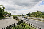
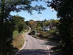
Shobley
Hampshire geography stubsNew Forest DistrictVillages in Hampshire
Shobley is a small hamlet in the New Forest National Park of Hampshire, England. Its nearest town is Ringwood, which lies approximately 1.8 miles (2.9 km) west from the hamlet. It is in the civil Parish of Ellingham, Harbridge and Ibsley.
Excerpt from the Wikipedia article Shobley (License: CC BY-SA 3.0, Authors).Shobley
Linford Road, New Forest Ringwood
Geographical coordinates (GPS) Address Nearby Places Show on map
Geographical coordinates (GPS)
| Latitude | Longitude |
|---|---|
| N 50.85734 ° | E -1.742797 ° |
Address
Linford Road
Linford Road
BH24 1TX New Forest, Ringwood
England, United Kingdom
Open on Google Maps


