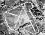
Ellingham, Harbridge and Ibsley
Ellingham, Harbridge and Ibsley is a civil parish in the west of the English county of Hampshire. The population of the civil parish at the 2011 Census was 1,171.The civil parish was formed in 1974 by the amalgamation of the three titular villages which had all been civil parishes in their own right, it forms part of the New Forest District. The main geographical features of the area are the A338 road (connecting Poole and Bournemouth with Salisbury) and the Hampshire Avon. The nearest towns are Ringwood and Fordingbridge. Populated places in the parish include: Ellingham Furze Hill Harbridge Highwood Ibsley Linford Linwood Mockbeggar Moyles Court School Poulner Rockford Shobley Somerley South Gorley Turmer
Excerpt from the Wikipedia article Ellingham, Harbridge and Ibsley (License: CC BY-SA 3.0, Authors).Ellingham, Harbridge and Ibsley
Newtown Lane, New Forest Ellingham, Harbridge and Ibsley
Geographical coordinates (GPS) Address Nearby Places Show on map
Geographical coordinates (GPS)
| Latitude | Longitude |
|---|---|
| N 50.883333333333 ° | E -1.7625 ° |
Address
Newtown Lane
Newtown Lane
BH24 3NN New Forest, Ellingham, Harbridge and Ibsley
England, United Kingdom
Open on Google Maps


