place

Westbourne, London

Areas of LondonDistricts of the City of WestminsterUse British English from September 2015Westbourne, London
Paddington Met. B Ward Map 1916

Westbourne is an area west of Paddington in west London. It has a manorial history spanning many centuries, within a more broadly defined Paddington, before shedding its association in the mid-19th century. It is named after the west bourne, West Bourne, or River Westbourne, a Thames tributary which was encased in 19th-century London in the 1850s. The spring-fed stream and associated manor have led to the place names Westbourne Green, Westbourne Park and more narrowly: Westbourne Gardens, Westbourne Grove, Westbourne Park Road, Westbourne Park tube station, Westbourne Studios and the name of a public house. Westbourne forms or resembles an electoral ward of the local authority which is, since 1965, Westminster City Council, and an ecclesiastical parish in the Church of England. Westbourne Conservation Area is a smaller area, designated by the local authority, in Planning Law.

Excerpt from the Wikipedia article Westbourne, London (License: CC BY-SA 3.0, Authors, Images).

Westbourne, London
Sutherland Place, City of Westminster Maida Hill

Geographical coordinates (GPS) Address Nearby Places
placeShow on map

Wikipedia: Westbourne, LondonContinue reading on Wikipedia

Geographical coordinates (GPS)

Latitude Longitude
N 51.516 ° E -0.197 °
placeShow on map

Address

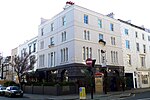
Sutherland Place 35
W2 5BZ City of Westminster, Maida Hill
England, United Kingdom
mapOpen on Google Maps

Paddington Met. B Ward Map 1916
Share experience

Nearby Places

Leinster Square
Leinster Square

Leinster Square () and Prince's Square are mirroring garden squares in Bayswater on the cusp of Westbourne and Notting Hill. One street overlaps (is shared by) the two squares. It is within the large, 1965, additions to the City of Westminster, London, W2. The square is in a broad cluster of Victorian estates of private housing with aesthetic landscaping and architecture. These include Prince's Square of symmetrical design, which the square fronts, Hereford Road and Garway Road. It close to Westbourne Grove, the major retail road running across Notting Hill and Tube stations: Bayswater, Queensway and Notting Hill Gate. Much of the area's war damage in the London Blitz was rapidly repaired with houses rebuilt to match the original tall terraces. Grade II listed tall Victorian terraced houses encompass the square, which, on the Hereford Road side, features a proportion of restaurants and cafés. The buildings have basements with black railings, slate mansard roofs, sash windows and yellow bricks with white stucco projections, pediments and dressings. As of 2015, a string of high-end developments is taking place in the square, with new flats and townhouses built behind the façade of two former hotels.The buildings surrounding the square are listed Grade II on the National Heritage List for England. The buildings are grouped into individual listings as 1–6, 7–16, 17–20, 23–26, 21 and 22, 27–34, and 38–57 Leinster Square.35–37 and 58–64 and Leinster Square are listed in two groups with buildings in adjacent Prince's Square.

Powis Square, London

Powis Square is a garden square and locality in Notting Hill, in the Royal Borough of Kensington and Chelsea in London, England. The closest London Underground station to the square is Westbourne Park tube station. It was planned in the mid-19th century by noted local architect Thomas Allom. There is conflicting information as to whether the square was named, along with nearby Arundel Gardens and Talbot Road, after the Talbot family of the Earls of Shrewsbury, or after Powis Castle owing to the Welsh Marches origins of the land's leaseholder, W. K. Jenkins.Originally built as upper-middle class residences, the area experienced dramatic social decline in the 20th century and was described as being "largely a slum area" by the 1930s. The square and surrounding areas were later exploited by the notorious slum landlord Peter Rachman who, in the 1950s and 60s, had acquired many properties on the square and in the surrounding area.In 1968, the council bought the garden square after a series of 'break-ins' by activists campaigning for social change towards the end of slum-era Notting Hill. Today, Powis Square Gardens is now one of three publicly-accessible pocket parks in the Portobello Road area along with Tavistock Gardens, and Colville Square Gardens.The Tabernacle, a local community arts centre with a long association with the Notting Hill Carnival, is located there.In 1962, The Rolling Stones' Brian Jones lived on the west side of the square.25 Powis Square was used for exterior scenes in Nicolas Roeg's 1970 film Performance, starring James Fox and Mick Jagger. The square is also referenced in the 1985 song "E=MC²" by Big Audio Dynamite, which was partially inspired by the film.Lemmy Kilmister gave his debut as a bass player for Hawkwind on a free open air concert at a park on Powis Square in August 1971.Roy Stewart ran a basement gymnasium at 32A Powis Square, Kensington, west London which was opened in 1954.