place

Campo de Cahuenga

1847 establishments in Alta California19th century in Los AngelesButterfield Overland Mail in CaliforniaCalifornia Historical LandmarksConquest of California
Historic districts on the National Register of Historic Places in CaliforniaHistoric house museums in CaliforniaHistory of the San Fernando ValleyHouses on the National Register of Historic Places in Los AngelesLos Angeles Historic-Cultural MonumentsMission Revival architecture in CaliforniaMuseums in Los AngelesNRHP infobox with nocatNational Register of Historic Places in the San Fernando ValleyPages including recorded pronunciationsParks in Los Angeles County, CaliforniaSpanish Colonial Revival architecture in CaliforniaStagecoach stops in the United StatesStudio City, Los AngelesTongva populated places
Campo de cahuenga detail

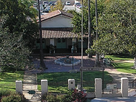
The Campo de Cahuenga, ( (listen)) near the historic Cahuenga Pass in present-day Studio City, California, was an adobe ranch house on the Rancho Cahuenga where the Treaty of Cahuenga was signed between Lieutenant Colonel John C. Frémont and General Andrés Pico in 1847, ending hostilities in California between Mexico and the United States. The subsequent Treaty of Guadalupe Hidalgo of 1848, ceding California, parts of Colorado, Nevada, New Mexico, and Arizona (but not Texas since it had seceded from Mexico in 1836, declared itself a republic, and joined the union in 1845) to the United States, formally ended the Mexican–American War. From 1858 to 1861 the Campo de Cahuenga became a Butterfield Stage Station.

Excerpt from the Wikipedia article Campo de Cahuenga (License: CC BY-SA 3.0, Authors, Images).

Campo de Cahuenga
Lankershim Boulevard, Los Angeles

Geographical coordinates (GPS) Address Nearby Places
placeShow on map

Wikipedia: Campo de CahuengaContinue reading on Wikipedia

Geographical coordinates (GPS)

Latitude Longitude
N 34.14 ° E -118.36166666667 °
placeShow on map

Address

Lankershim Boulevard

Lankershim Boulevard
91608 Los Angeles
California, United States
mapOpen on Google Maps

Campo de cahuenga detail
Share experience

Nearby Places

Universal City, California

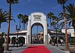
Universal City is an unincorporated area within the San Fernando Valley region of Los Angeles County, California, United States. Approximately 415 acres (1.7 km²) within and around the surrounding area is the property of Universal Pictures, one of the five major film studios in the United States: about 70 percent of the studio's property is inside this unincorporated area, while the remaining 30 percent is within the Los Angeles city limits. Universal City is primarily surrounded by Los Angeles with its northeastern corner touching the city of Burbank, making the unincorporated area a county island. Located within the area of Universal City is the Universal Studios Hollywood film studio and theme park, as well as the Universal CityWalk shopping and entertainment center. Within the Los Angeles city limits lies 10 Universal City Plaza, a 36-floor office building for Universal and NBC; the Sheraton Universal; and the Universal Hilton. The Metro B Line underground station of the same name is located opposite the 10 Universal Plaza. A Los Angeles County Sheriff's Department (LASD) station is located at Universal CityWalk, and the community also houses the only government-funded fire station in the United States located on private property. The Los Angeles County Fire Department (LACFD) Station 51 (formally Station 60 until the mid 1990s) is of special significance to Universal, as "Station 51" was the fictional setting of the Universal and Jack Webb television series Emergency!. However, the current Station 51 was not used for external shots, or used as a model for the interior shots seen on the show (LACFD Station 127 in Carson was used). Universal City's ZIP code is 91608, and the community is inside area code 818.