place

Pic Eccles

Alpine four-thousandersMont Blanc massifMountains of Aosta ValleyMountains of the Alps

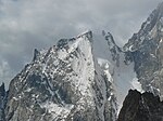
Pic Eccles (4,041 m) is a mountain in the Mont Blanc massif in the Aosta Valley, Italy. It lies at the foot of the Innominata ridge to the summit of Mont Blanc. The mountain is named after the English mountaineer and geologist James Eccles. Although the mountain was probably climbed on 31 August 1874 by J. G. A. Marshal with guides Johann Fisher and Ulrich Almer, the first certain ascent was on 30–31 August 1877 by James Eccles with guides Alphonse and Michel Payot during the first ascent of Mont Blanc de Courmayeur.

Excerpt from the Wikipedia article Pic Eccles (License: CC BY-SA 3.0, Authors).

Pic Eccles
Sentiero per Rifugio Monzino,

Geographical coordinates (GPS) Address Website Nearby Places
placeShow on map

Wikipedia: Pic EcclesContinue reading on Wikipedia

Geographical coordinates (GPS)

Latitude Longitude
N 45.821666666667 ° E 6.8744444444444 °
placeShow on map

Address

Bivacco Giuseppe Lampugnani (Bivacco Eccles)

Sentiero per Rifugio Monzino

Aosta Valley, Italy
mapOpen on Google Maps

Website
clubalpinoaccademico.it

linkVisit website

Share experience

Nearby Places

Grand Pilier d'Angle

The Grand Pilier d'Angle (4,243 m) is a buttress on the southern side of Mont Blanc in the Mont Blanc massif in the Aosta Valley, Italy. The first ascent from the valley was by James Eccles with guides Michel Payot and Alphonse Payot on 30 July 1877 during an ascent of the Peuterey ridge, although the summit had been visited on 20 August 1822 by F. Clissold with guides J. M. Couttet, M. Bossonney, D. Couttet, P. Favret and J. B. Simond on the descent from their first ascent of Mont Blanc de Courmayeur. The first ascent of the pillar (the north-east face) itself was by Walter Bonatti and Toni Gobbi on 3 August 1957. Bonatti said after the climb that "the mixed terrain of the face was without doubt the most sombre, the most savage and the most dangerous of any that I have ever encountered in the Alps." The first winter ascent of the Bonatti-Gobbi route was by A. Dworak, J. Kurczab, A. Mróz and T. Piotrowski between 5 and 9 March 1971. The first solo ascent of the route was by Nicolas Jaeger on 3 August 1975. Other well-known routes on the face include the Cecchinel-Nominé (Walter Cecchinel and Georges Nominé, 17 September 1971; the Boivin-Vallençant of 1975 adds a direct finish to this route) and Divine Providence (Patrick Gabarrou and François Marsigny, 5–7 June 1984). The first solo ascent of this route was by Jean-Christophe Lafaille in 1990, who said, "This route is the most difficult and involving in the whole of the Mont Blanc massif."

Mont Blanc
Mont Blanc

Mont Blanc (French: Mont Blanc [mɔ̃ blɑ̃]; Italian: Monte Bianco [ˈmonte ˈbjaŋko], both meaning "white mountain") is the highest mountain in the Alps and Western Europe, and the highest mountain in Europe outside the Caucasus mountains, rising 4,807.81 m (15,774 ft) above sea level, located on the French-Italian border. It is the second-most prominent mountain in Europe, after Mount Elbrus, and it is the eleventh most prominent mountain summit in the world.It gives its name to the Mont Blanc massif, which straddles parts of France, Italy and Switzerland. Mont Blanc's summit lies on the watershed line between the valleys of Ferret and Veny in Italy, and the valleys of Montjoie, and Arve in France. Ownership of the summit area has long been disputed between France and Italy. The Mont Blanc massif is popular for outdoor activities like hiking, climbing, trail running and winter sports like skiing, and snowboarding. The most popular climbing route to the summit of Mont Blanc is the Goûter Route, which typically takes two days. The three towns and their communes which surround Mont Blanc are Courmayeur in Aosta Valley, Italy; and Saint-Gervais-les-Bains and Chamonix in Haute-Savoie, France. The latter town was the site of the first Winter Olympics. A cable car ascends and crosses the mountain range from Courmayeur to Chamonix through the Col du Géant. The 11.6 km (7+1⁄4 mi) Mont Blanc Tunnel, constructed between 1957 and 1965, runs beneath the mountain and is a major transalpine transport route.

Mont Blanc massif
Mont Blanc massif

The Mont Blanc massif (French: Massif du Mont-Blanc; Italian: Massiccio del Monte Bianco) is a mountain range in the Alps, located mostly in France and Italy, but also straddling Switzerland at its northeastern end. It contains eleven major independent summits, each over 4,000 metres (13,123 ft) in height. It is named after Mont Blanc (4,808 metres (15,774 ft)), the highest point in western Europe and the European Union. Because of its considerable overall altitude, a large proportion of the massif is covered by glaciers, which include the Mer de Glace and the Miage Glacier – the longest glaciers in France and Italy, respectively. The massif forms a watershed between the vast catchments of the rivers Rhône and Po, and a tripoint between France, Italy and Switzerland; it also marks the border between two climate regions by separating the northern and western Alps from the southern Alps. The mountains of the massif consist mostly of granite and gneiss rocks and at high altitudes the vegetation is an arctic-alpine flora. The valleys that delimit the massif were used as communication routes by the Romans until they left around the 5th century AD. The region remained of some military importance through to the mid-20th century. A peasant farming economy operated within these valleys for many centuries until the glaciers and mountains were "discovered" by the outside world in the 18th century. Word of these impressive sights began to spread, and Mont Blanc was first climbed in 1786, marking the start of the sport of mountaineering. The region is now a major tourist destination, drawing in over six million visitors per year. It provides a wide range of opportunities for outdoor recreation and activities such as sight-seeing, hiking, rock climbing, mountaineering and skiing. Around one hundred people a year die across its mountains and, occasionally, bodies have been lost and entombed in its glaciers for decades. Access into the mountains is facilitated by cable cars, mountain railways and mountain huts which offer overnight refuge to climbers and skiers. The long-distance Tour du Mont Blanc hiking trail circumnavigates the whole massif in an 11-day trek of 170 kilometres (110 mi). The Mont Blanc Tunnel connects the French town of Chamonix on the northern side with the Italian town of Courmayeur in the south. The high mountains have provided many opportunities for scientific research, including neutrino measurements within the tunnel and impact of climate change on its highest slopes. Recent rises in average temperatures have led to significant glacial retreat across the massif and an awareness of the need for better environmental protection, including a call for World Heritage Site status.