Voyageur Provincial Park
Canadian protected area stubsEastern Ontario geography stubsIUCN Category IIProtected areas of the United Counties of Prescott and RussellProvincial parks of Ontario ... and 1 more
Year of establishment missing

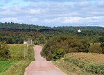
Voyageur Provincial Park is a provincial park located in eastern Ontario, Canada, opposite the once furious Long Sault rapids of the Ottawa River around which voyageurs portaged on their way upstream. Established in 1966, the park was formerly known as Carillon Provincial Park.The park has 416 campsites, 110 with electrical service. Group camping is also available. The park has a day-use area and comfort stations for campers. There are two hiking trails—Coureur de Bois Trail (2 km; 1¼ miles, 1 hour) and Outouais Trail (5 km; 3 miles return)—both rated easy. In the winter, cross-country ski trails are available.
Excerpt from the Wikipedia article Voyageur Provincial Park (License: CC BY-SA 3.0, Authors, Images).Voyageur Provincial Park
Highway 417, East Hawkesbury
Geographical coordinates (GPS) Address Nearby Places Show on map
Geographical coordinates (GPS)
| Latitude | Longitude |
|---|---|
| N 45.554722222222 ° | E -74.453333333333 ° |
Address
Highway 417
Highway 417
K0B 1B0 East Hawkesbury
Ontario, Canada
Open on Google Maps


