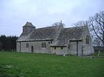
Leigh, Wiltshire

Leigh is a village and civil parish in north Wiltshire, England, 1.5 miles (2.4 km) southeast of Ashton Keynes and 2.5 miles (4 km) west of Cricklade. It is on the edge of the Cotswold Water Park and near to the county border with Gloucestershire. The parish includes the hamlet of Waterhay. The village lies on a minor road just north of the B4040 Malmesbury–Cricklade road. The infant River Thames forms part of the northern boundary of the parish; near the river is Upper Waterhay Meadow, a biological Site of Special Scientific Interest. Other boundaries are a short section of the Swill Brook which meets the Thames in the northwest; its tributary the Derry Brook in the west; and the Bournlake stream in the east.
Excerpt from the Wikipedia article Leigh, Wiltshire (License: CC BY-SA 3.0, Authors, Images).Leigh, Wiltshire
Swan Lane,
Geographical coordinates (GPS) Address Nearby Places Show on map
Geographical coordinates (GPS)
| Latitude | Longitude |
|---|---|
| N 51.628 ° | E -1.912 ° |
Address
All Saints' Church
Swan Lane
SN6 6RD
England, United Kingdom
Open on Google Maps


