Aragua
AraguaPages with Spanish IPAStates and territories established in 1899States of Venezuela

Aragua State (Spanish: Estado Aragua, IPA: [esˈtaðo aˈɾaɣwa]) is one of the 23 states of Venezuela. Located in the Central Region of Venezuela, it has plains, jungles, and Caribbean beaches, of which the most popular are Cata and Choroni. It has Venezuela's first national park, Henri Pittier National Park. The capital is Maracay, and it includes other important cities like Turmero and El Limón. Aragua State covers a total surface area of 7,014 km2 (2,708 sq mi) and, based on the 2011 census information, the estimated population of Aragua State in 2012 is 1,630,308 inhabitants.
Excerpt from the Wikipedia article Aragua (License: CC BY-SA 3.0, Authors, Images).Aragua
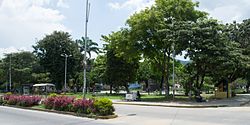
Avenida Miranda, Maracay
Geographical coordinates (GPS) Address Nearby Places Show on map
 Continue reading on Wikipedia
 Geographical coordinates (GPS)
| Latitude | Longitude |
|---|---|
| N 10.25 ° | E -67.6 ° |
Address
Farmacia Aragua
Avenida Miranda
1201 Maracay
Aragua State, Venezuela
Open on Google Maps