Poole Harbour
EngvarB from October 2013Geography of PooleNature Conservation Review sitesPoole HarbourPoole Harbour catchment ... and 4 more
Ports and harbours of DorsetRamsar sites in EnglandSites of Special Scientific Interest in DorsetSpecial Protection Areas in England

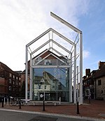
Poole Harbour is a large natural harbour in Dorset, southern England, with the town of Poole on its shores. The harbour is a drowned valley (ria) formed at the end of the last ice age and is the estuary of several rivers, the largest being the Frome. The harbour has a long history of human settlement stretching to pre-Roman times. The harbour is extremely shallow (average depth 48 cm [19 in]), with one main dredged channel through the harbour, from the mouth to Holes Bay.Poole Harbour has an area of approximately 36 km2 (14 sq mi). It is one of several which lay claim to the title of "second largest natural harbour in the world" (after Port Jackson, Sydney).
Excerpt from the Wikipedia article Poole Harbour (License: CC BY-SA 3.0, Authors, Images).Poole Harbour
Middle Street,
Geographical coordinates (GPS) Address Nearby Places Show on map
Geographical coordinates (GPS)
| Latitude | Longitude |
|---|---|
| N 50.695833333333 ° | E -1.9886111111111 ° |
Address
Middle Street
BH13 7EE , Studland
England, United Kingdom
Open on Google Maps


