place

Alton, Leicestershire

Deserted medieval villages in LeicestershireLeicestershire geography stubsOpenDomesdayUse British English from July 2015

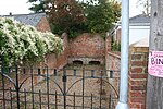
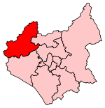
Alton is a deserted medieval village between Coalville and Ashby-de-la-Zouch, in North West Leicestershire, England. The earliest documentation of the village is found in the Domesday Book where it appears as Heletone. The land was rented out to someone by Hugh de Grandmesnil, and had a total value of 60 shillings. There were 25 villagers, 1 being a man at arms and 4 smallholders. There were 8 ploughs, 1 mill, 4 acres of meadow, woodland 1 league long. The name is probably derived from ald, and the suffix tūn, meaning "old settlement".It is one of only four villages in Leicestershire that seems to have been deserted as a result of grange formation, the others being Dishley, Ringlethorp and Weston. The most important possessor of granges in Leicestershire was the Cistercian Garendon Abbey whose economy was largely based on sheep farming. Nothing remains of the village other than a few vague topographical features.

Excerpt from the Wikipedia article Alton, Leicestershire (License: CC BY-SA 3.0, Authors).

Alton, Leicestershire
Alton Hill, North West Leicestershire Ravenstone with Snibstone

Geographical coordinates (GPS) Address Nearby Places
placeShow on map

Wikipedia: Alton, LeicestershireContinue reading on Wikipedia

Geographical coordinates (GPS)

Latitude Longitude
N 52.731 ° E -1.423 °
placeShow on map

Address

Alton Hill

Alton Hill
LE65 1TH North West Leicestershire, Ravenstone with Snibstone
England, United Kingdom
mapOpen on Google Maps

Share experience

Nearby Places

Normanton le Heath
Normanton le Heath

Normanton le Heath is a village and civil parish situated between the parishes of Packington, Ravenstone and Heather in North West Leicestershire, England. The population of the civil parish was 131 at the 2001 census, rising to 165 at the 2011 census. It should not be confused with another Normanton in the county which is near Bottesford. The name, which in Old English means the settlement of Northmen on the heath, suggests that the current village was probably an English village taken over by a group of Norse or Danish settlers at the time of the original Viking settlement, and this fits well into the overall pattern of land occupation in the area. It lies on the edge of the great heath that once stretched Westwards from the edge of Charnwood Forest, something which is reflected in the names of a number of other settlements in the area, such as Heather and Donington le Heath. There are, however, signs of significant earlier land usage in the parish. Near to the boundary with Heather and Ravenstone an Iron Age settlement has been discovered. Equally, the newly discovered Roman road from Leicester to Chester has been discovered running through the centre of Normanton. Just over the parish boundary in the southern Ravenstone area there was a small Roman town. A track called the Swepstone Way can be traced running from the Iron Age settlement all the way to Tamworth. The Salt Way which ran through Measham can also be traced to Normanton. It is not totally implausible to suggest that a road/track ran through the centre from Ancaster to Wall. If this is correct it would suggest that this track was of Roman origin. However, this is very much a speculative road at the moment. The settlement is not mentioned in the Domesday Book and the first mention we have is in 1209. Much of the land in the early Middle Ages to the north was known to be woodland or heathland. Coal mining formed part of the economy of the area from a very early period and mines have been found at the abandoned village of Alton to the north of Normanton. To the east of the village was the Long Moor open cast coal mine managed by UK Coal. Over a three-year period from 2007 to 2010 this extracted 725,000 tons of coal. Following restoration, the 188 acres (76 ha) mine site has been acquired by the Woodland Trust. With adjoining agricultural land this will become the Flagship Diamond Wood, a 186 hectares (460 acres) new woodland to celebrate the 2012 Diamond Jubilee of Queen Elizabeth II.

Coleorton
Coleorton

Coleorton ( kə-LOR-tən) is a village and civil parish in North West Leicestershire, England. It is situated on the A512 road approximately 2 miles (3.2 km) east of Ashby de la Zouch. Nearby villages include Newbold, to the north, Thringstone to the east, and Swannington to the south-east. In the 2001 census, the population of the parish was 1,016, increasing to 1,177 at the 2011 census.The village's name means 'farm/settlement on a ridge'. 'Cole' derives from the Old English col meaning coal, which was first appended here in 1443Formerly an ancient parish in West Goscote hundred, Coleorton became part of Ashby de la Zouch Rural District which was created in 1894.Coal mining was an important industry in the area since the 15th century. In 1572, the miners worked in gangs of 10-20 men, with the gang paid one shilling for each 'rook' they dug out (the rook was a fixed quantity, believed to be c. 1-2 tons). Coleorton Colliery, which was between Coleorton and Swannington, is now closed, and a woodland Coleorton Wood was planted in 1991–2 on the colliery site as part of the National Forest. Opencast mining operated between 1985 and 1995.Coleorton was the birthplace of William Stenson (1771–1861), founder of Whitwick Colliery and 'Father of Coalville' The Grade II* listed Coleorton Hall, in the west of the parish, was built in 1804-8 for the art patron Sir George Beaumont. William Wordsworth was a regular and frequent guest of Sir George Beaumont at the Hall. Between 1948 and 1997 the house was owned by the National Coal Board and used as offices, and it has now been converted into apartments.Coleorton has a post office and is served by three public bus services.