Derby (ward)
Merseyside geography stubsWards of the Metropolitan Borough of Sefton
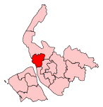
Derby is a Metropolitan Borough of Sefton ward in the Bootle Parliamentary constituency that covers the area of the town of Bootle centred on the Derby park for which the ward is named after. The population taken at the 2011 census was 12,360.
Excerpt from the Wikipedia article Derby (ward) (License: CC BY-SA 3.0, Authors).Derby (ward)
Earl Road,
Geographical coordinates (GPS) Address Nearby Places Show on map
Geographical coordinates (GPS)
| Latitude | Longitude |
|---|---|
| N 53.452805555556 ° | E -2.9803611111111 ° |
Address
Earl Road
Earl Road
L20 9BU
England, United Kingdom
Open on Google Maps


